Historical Maps

Historical maps showing territorial changes of countries and historical events of the past.
Historical Maps

How deep the Titanic sank?

Royal Mail Ship (RMS) Titanic was a British passenger liner that sank in the North Atlantic Ocean after it collided with an iceberg during its maiden voyage from Southampton to New York City. The ship had around 2,224 passengers and crew members onboard, but unfortunately, over 1,500 of them lost their lives, making it one of the most lethal maritime disasters during peacetime in recent history.

Read more: How deep the Titanic sank?
Historical Maps

Slavery in the Americas: A Historical Overview

Slavery in the Americas began with the arrival of the first Africans, who were primarily imported by Spain and Portugal. This brutal practice expanded significantly with the establishment of sugar plantations in Brazil and spread throughout the continent. Millions of Africans were forcibly brought to the Americas, shaping the economic and social foundations of the New World by the 18th century.

Read more: Slavery in the Americas: A Historical Overview
Historical Maps

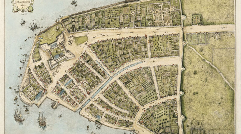
The Changing Shoreline of New York City

Manhattan below City Hall is 50% larger than in the 1620s. Maps show the Heere Gracht canal (1626-1676), English water lots that added 500 acres by 1776, Castle Clinton built 300 feet offshore in 1808, Egbert Viele’s 1865 map showing landfill extent, Battery Park City’s 92 acres from World Trade Center excavation (1968-1976), and T. Kennard Thomson’s 1911 plan to dam the East River.

Read more: The Changing Shoreline of New York City