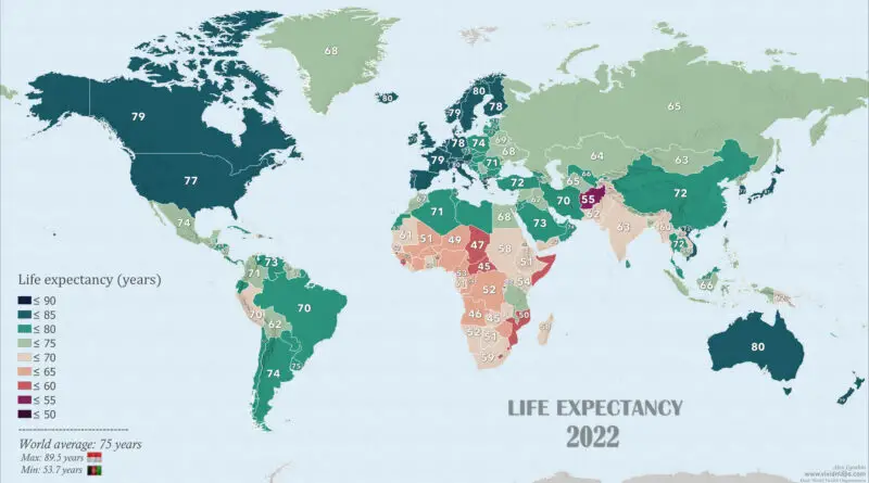
Life Expectancy Worldwide Mapped (2000-2022)
Global life expectancy has been on an upward trajectory, reflecting improvements in healthcare, sanitation, and living conditions. The world average life expectancy is around 75 years, according to data from the World Bank. However, significant disparities exist among regions and countries, with higher-income nations generally experiencing longer life expectancies than lower-income ones. Factors influencing life expectancy include access to healthcare, socioeconomic conditions, education, and lifestyle choices. Ongoing efforts to address public health challenges and enhance healthcare systems contribute to the overall improvement in life expectancy worldwide.
Read More