The Deadliest Month in Every U.S. State
January is the deadliest month in 39 of the 50 U.S. states, but eight states peak in February, two in March, and one in December instead.
Read more: The Deadliest Month in Every U.S. State
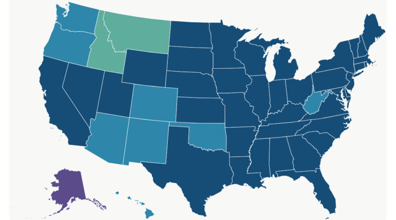
January is the deadliest month in 39 of the 50 U.S. states, but eight states peak in February, two in March, and one in December instead.
Read more: The Deadliest Month in Every U.S. State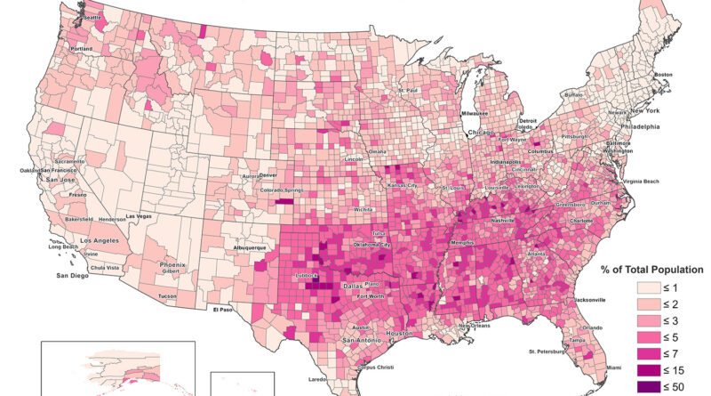
King County, Texas recorded the highest Evangelical Protestant share of any US county in 2020, at 45.25 percent. That is higher than any state’s own average, Alabama included.
Read more: Evangelical Protestant Population Mapped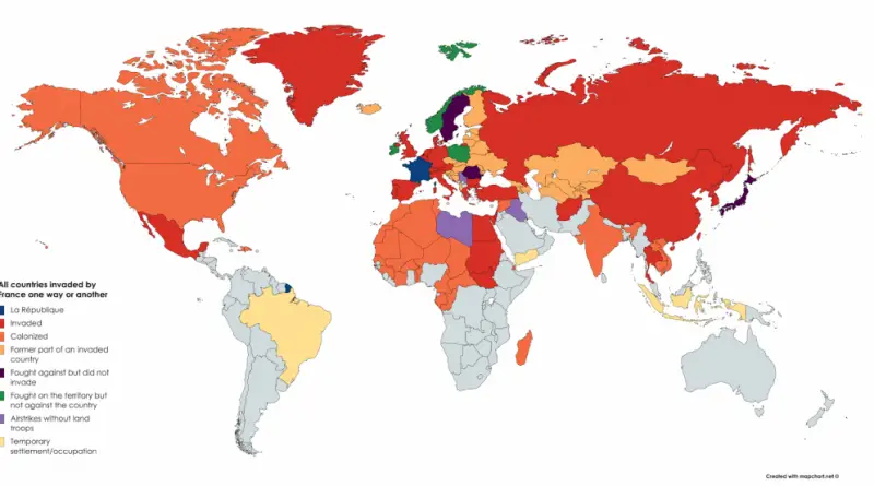
At its largest, France’s colonial holdings covered close to a quarter of the world’s land. Two overlapping empires, a world war that pulled them apart piece by piece, and the departments, territories, and ocean claim still left of it today.
Read more: All countries invaded by France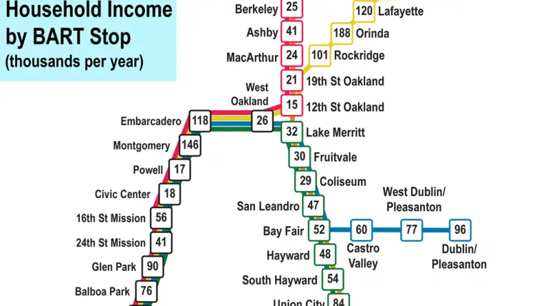
Fifty BART stations, fifty very different paychecks. Here is what Census data shows about household income near each stop.
Read more: Median Household Income by BART Station Across the Bay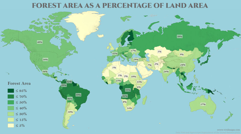
Forest still covers close to a third of the planet, but that average hides enormous differences between countries. Here is how much forest covers every nation on Earth, and how the global total has changed since 1990.
Read more: How Much of the World Is Still Covered in Forest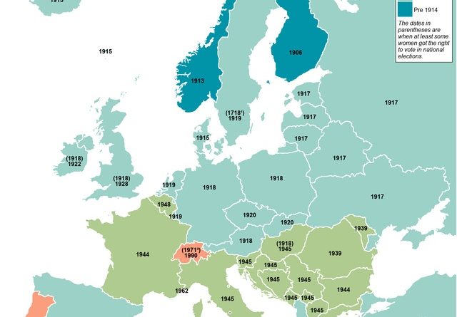
Starting in the mid-19th-century, women tried to alter voting legislation to permit them to vote. The first county in the world to award and maintain women’s suffrage continuously was Norway in 1913.
Read more: The year women gained the right to vote in Europe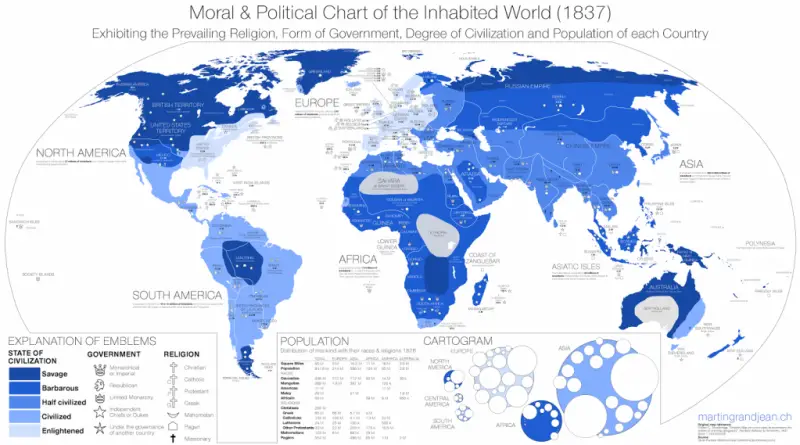
A Connecticut classroom atlas from 1837 sorted the entire world into five stages of civilization, from Savage to Enlightened.
Read more: Moral and Political Chart of the Inhabited World (1837)Separation sections of international land or river borders, unconnected by territorial waters, clusters of exclaves are represented by their smallest
Read more: 10 of the world’s shortest borders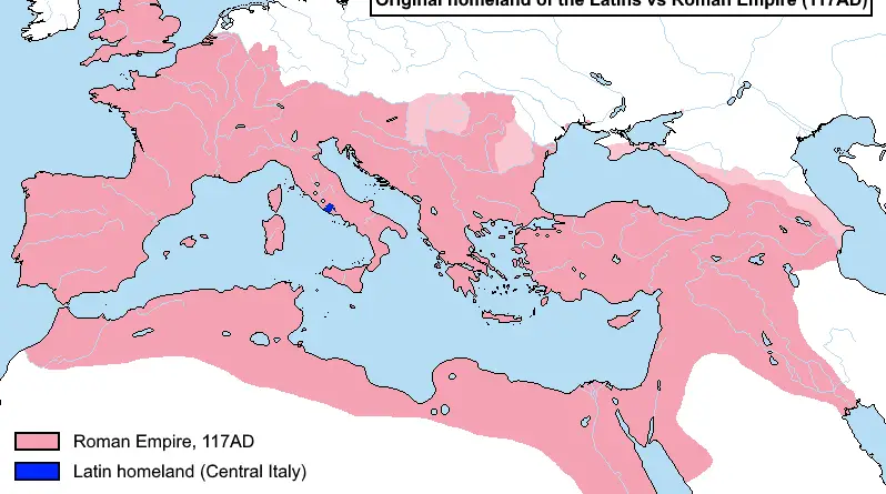
A small Italic tribe from Latium gave Rome its language. Here is how that tiny homeland compares to the empire Latin eventually spread across, and why the language split apart afterward.
Read more: Original Homeland of the Latins vs Roman Empire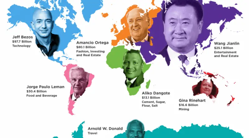
North America has produced the world’s richest person in 29 of the last 31 years, and Bill Gates alone accounts for 17 of them.
Read more: North America Has Produced the World’s Richest Person in 29 of the Last 31 Years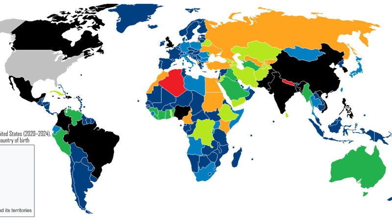
How the Diversity Visa program started, who actually wins it today.
Read more: America’s Green Card Lottery Began as a Favor to Ireland
Colima, Mexico, leads a list of 49 cities at 181.94 homicides per 100,000 residents.
Read more: Which Cities Have the Highest Homicide Rates?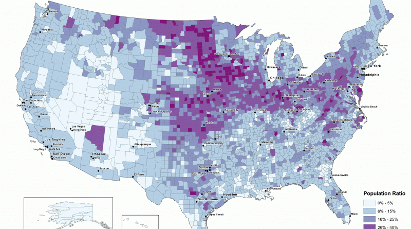
Nelson County, North Dakota recorded the highest Mainline Protestant share of any US county in 2020, at 69.45 percent. The next nine counties on the list are in North Dakota, Minnesota, Iowa, and South Dakota.
Read more: Mainline Protestant Population by State and County