Current military alliances in the world
NATO has expanded with Finland (2023) and Sweden (2024), reshaping European security. Explore current military alliances with updated maps.
Read More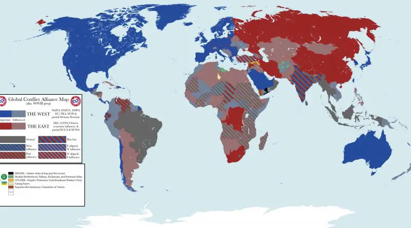
NATO has expanded with Finland (2023) and Sweden (2024), reshaping European security. Explore current military alliances with updated maps.
Read More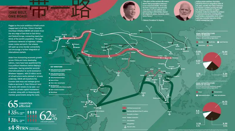
Discover how China’s One Belt, One Road Initiative aims to reshape global trade routes, foster international connectivity, and potentially redefine economic power dynamics worldwide.
Read More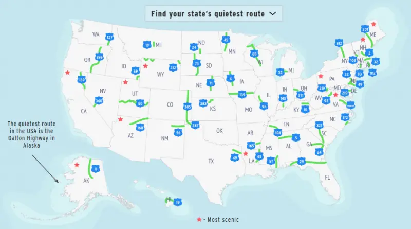
Want to escape the traffic and enjoy the open road? This map reveals the quietest highway in every U.S. state, from the isolated Dalton Highway in Alaska to Nevada’s legendary “Loneliest Road.” Plus, check out the most scenic routes for breathtaking views. See if your favorite made the list!
Read More
From WhatsApp’s dominance across continents to WeChat’s ecosystem in China, this map reveals how our choice of messaging apps reflects more than personal preference—it tells a story of digital borders shaped by culture, politics, and connectivity.
Read More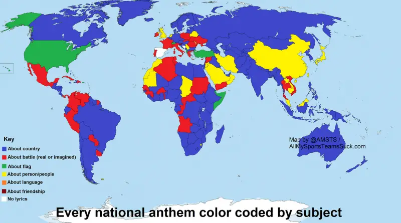
National anthems are more than just songs—they reflect a nation’s history, struggles, and values. A world map color-codes them by subject, while a European map examines their first words. But which country had the first anthem? Which anthem is the oldest? And how often do nations change their national songs? Let’s dive into the fascinating world of anthems.
Read More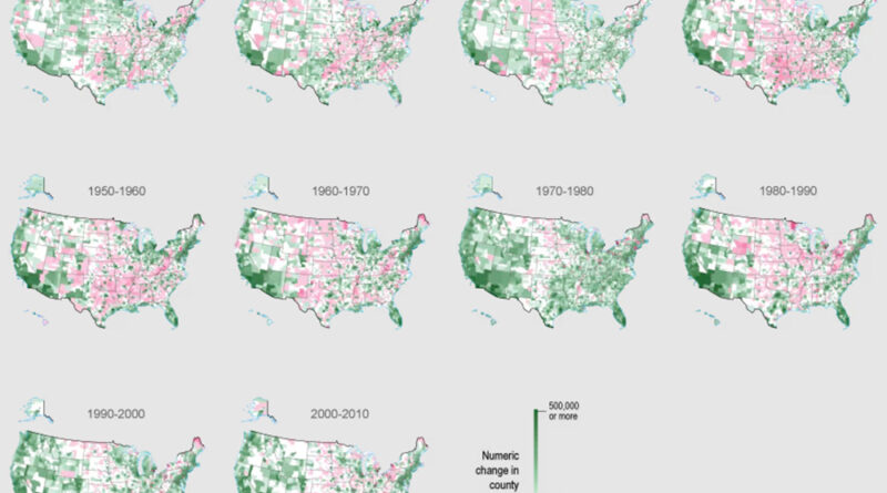
Dive into the evolving landscape of U.S. population distribution over the past century, highlighting areas of persistent growth and decline, and consider the implications for the future.
Read More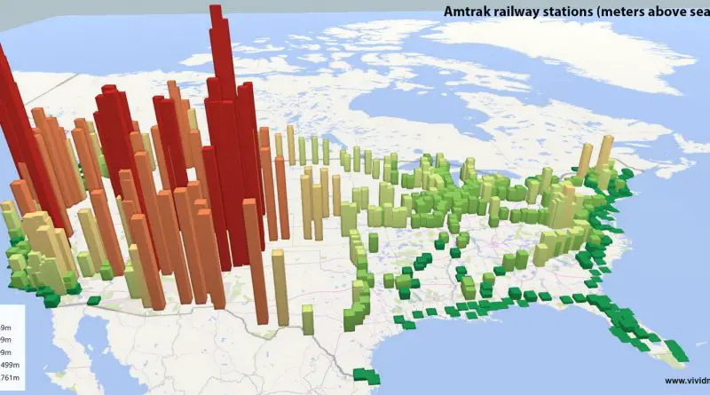
Journey through America’s loftiest and lowest railway stations, uncovering the histories of the Pikes Peak Cog Railway, the Leadville Railroad, Amtrak’s highest and lowest stations, and the rich legacy and future of U.S. railroads.
Read More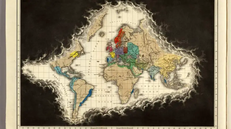
In 1551, European maps were full of gaps and speculation. This map, created during the reign of Charles V, reveals how people at the time viewed the world—what they knew, what they didn’t, and what they imagined.
Read More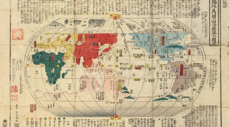
Japanese world maps from the 19th and early 20th centuries reveal how Japan perceived geography, trade, and global politics. See how accuracy, projection, and artistic styles evolved over time.
Read More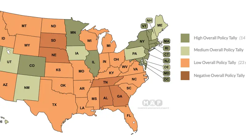
The map is based on scoring in a number of categories, such as “Recognition of Marriage” and “Protected Class” (for
Read More