There is more wealth in red area than in grey
Reddit user: eivarXlithuania Data source: Global Wealth Databook 2016 Wealth estimates by country www.vividmaps.com
Read More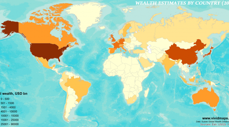
Reddit user: eivarXlithuania Data source: Global Wealth Databook 2016 Wealth estimates by country www.vividmaps.com
Read MoreDespite a warm-temperate climate similar to that of southern Japan, the coastal plain of the southeastern USA is usually described
Read MoreNASA A new map of the thickness of Mars’ crust shows less variation between thicker regions (red) and thinner regions
Read MoreWorst 5 schools: 1. Trinity Downtown Lutheran Church and School (Harris County, Texas)2. East Side Elementary School, P.S. 267 (New
Read More– The fame measure is a combination of article length, number of revisions and typical page views in 2016. (More
Read MoreReddit user: jkvatterholm
Read More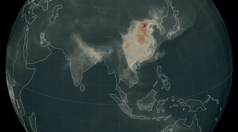
Reddit user: mmaronn
Read MoreItalians have been an integral part of America’s history, from the first waves of immigrants in the late 19th century to vibrant communities today. This post delves into the journey of Italians in America, highlighting where they settled, their contributions, and the spread of the Italian language. We’ll also explore the lives of famous Italians who have shaped American history and provide resources for those interested in learning Italian.
Read More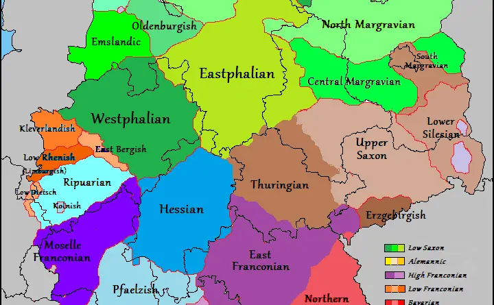
Journey through the rich linguistic heritage of the German language, uncovering the intricate tapestry of regional dialects that have shaped communication across German-speaking territories.
Read More