Peak month for pollution by U.S. county
Source: www.metricmaps.org/2017/06/23/peak-month-for-air-pollution-by-us-county
Read More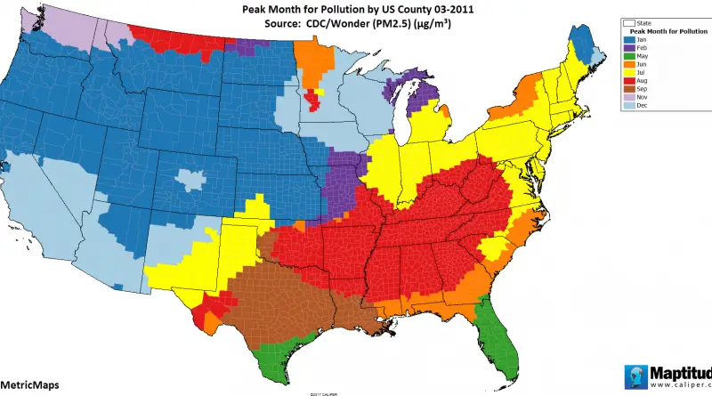
Source: www.metricmaps.org/2017/06/23/peak-month-for-air-pollution-by-us-county
Read MoreReddit user: jej_supreme
Read More
The American birth rate dropped for the 6th sequential year in 2020, with the lowest amount of children born since 1979. The drop in birth rates was observed among all observed racial groups.
Read More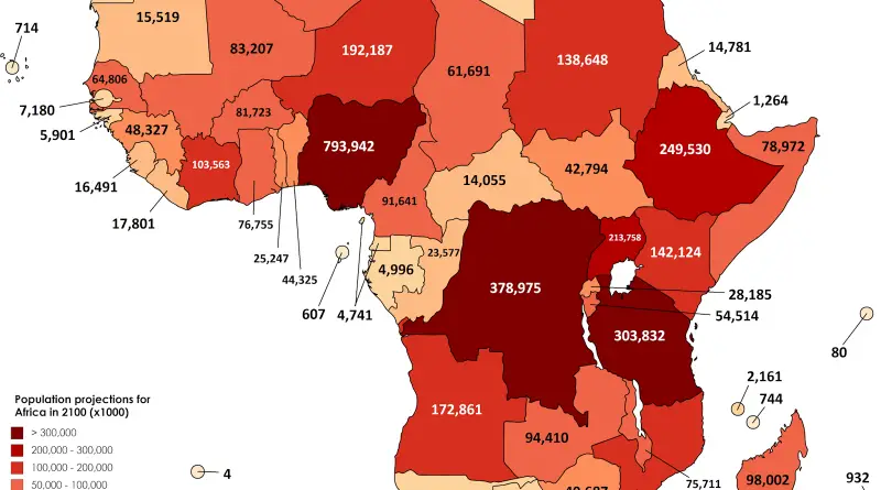
Reddit user: SwiftOryx
Read More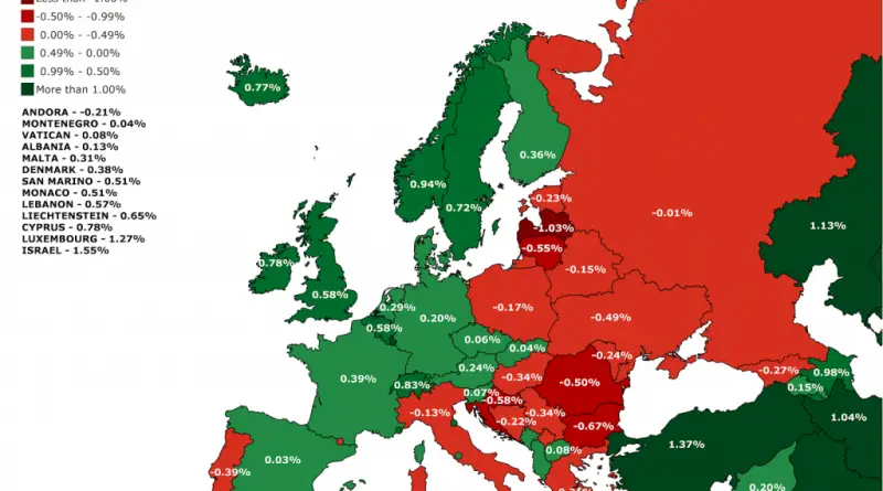
The 2017 Revision of World Population Prospects is the twenty-fifth round of official United Nations population estimates and projections that
Read MoreThe bureau on Thursday published its latest detailed population estimates for each of the more than 3,000 American counties. Sioux
Read MoreIn Alaska, if all variables fall into place, the days near the solstice often produce the warmest temperatures several weeks
Read MoreIt may seem as if we are regularly bombarded with inspiring innovations and discoveries in our contemporary times. Still, many new ideas and technologies forming our current world can frequently be traced back centuries in their origins.
Read More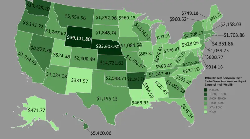
8 billionaires made fortunes in finance and 8 in retail. Nick DeSantis, www.forbes.com Richest In State list, Frank VanderSloot of
Read More