Average lightning strikes all over the planet
A lightning strike is an electric discharge within the atmosphere and the earth. About 69% percent of all lightning cases worldwide are striking between the atmosphere and earth-bound targets. Approximately 70% of lightning happens on the land in the Tropics
Read More
World with a 100 meters sea level rise
The global sea-level rise started around the beginning of the 20th century. From 1900 to 2016, the average sea level on the planet rose by 16–21 centimeters or 6.3–8.3 inches. According to the extreme scenario, an increase in sea level can be presumed as 189 centimeters (6.2 feet) by 2100.
Read MoreHousehold wealth levels (2000 – 2016)
Map summarizes information on household wealth this century for 173 countries, five regions, and the world as a whole. The
Read More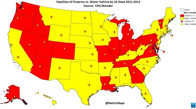
Fatalities of firearms vs motor vehicle by U.S. State
Related post: www.metricmaps.org/2017/06/12/fatalities-of-firearms-vs-motor-vehicle
Read MoreWhat is the Average Rent in Each U.S. State?
var divElement = document.getElementById(‘viz1497363671079’); var vizElement = divElement.getElementsByTagName(‘object’)[0]; if ( divElement.offsetWidth > 800 ) { vizElement.style.width=’629px’;vizElement.style.height=’769px’;} else if ( divElement.offsetWidth
Read More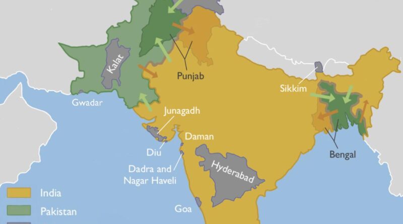
Partition of India Mapped
The Partition of India was the division of British India into two sovereign dominion nations, India and Pakistan. Nowadays, the Dominion of India is the Republic of India. The Dominion of Pakistan is today the Islamic Republic of Pakistan and the People’s Republic of Bangladesh. The partition involved two provinces, Bengal and Punjab, based on district-wide non-Muslim or Muslim majorities.
Read More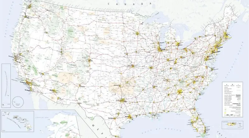
U.S. transportation infrastructure
The U.S. boasts a vast and diverse transportation infrastructure that serves as the backbone of its economy and daily life. At the heart of this network is an extensive system of highways and roads, including the iconic Interstate Highway System, connecting cities and regions across the country. This highway network facilitates the movement of goods and people, supporting commerce, tourism, and daily commuting.
Read More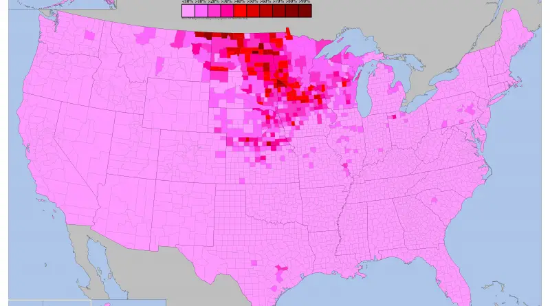
Rate of adherence to Lutheranism by U.S. county
Rate of adherence to Lutheranism by U.S. county The following denominations are combined on this map: American Association of Lutheran
Read MoreWorld map by Ferrando Bertelli (1565)
Ferrando Bertelli was born in Venice in 1525. He was one of the most creative of Venetian map maker and engravers of the Renaissance period, who also traded atlases and worked at different periods with other famous names in Venetian cartography.
Read More