Most Americans’ best days are behind them
Median household income peaked at least 15 years ago in 81% of US counties. Source: washingtonpost.com
Read MoreMedian household income peaked at least 15 years ago in 81% of US counties. Source: washingtonpost.com
Read MoreReddit user: palmfranz
Read MoreRelative web search popularity of satanism (5 year sample). Reddit user: Wakagoshi
Read MoreReddit user: sangeetpaul
Read More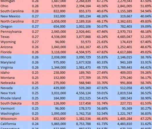
Reddit user: anotherblue States ranked by % of non-elderly with pre-existing medical condition colored by Presidential vote Data: kff.org
Read More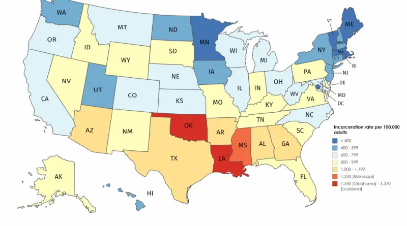
Most prisoners are in Louisiana, Oklahoma and Mississippi. Reddit user: whiplashoo21 Louisiana is the world’s prison capital. Louisiana’s incarceration rate is nearly
Read More
England’s Immigrants 1330-1550 where they came from.
Read MoreRelated post: – Jail incarceration rate per 100,000 U.S. county residents
Read More