Major forest types of the United States (1967)
Compiled from information furnished by the United States Forest Service. Related post: – U.S. Vegetation Map (1970)
Read MoreCompiled from information furnished by the United States Forest Service. Related post: – U.S. Vegetation Map (1970)
Read Moretaxfoundation.org Top Ten Counties for State & Local Deductions 1. New York County, NY – $24,8982. Marin County, CA –
Read MoreReddit user: whistlebug23 Data: pure-gas.org
Read More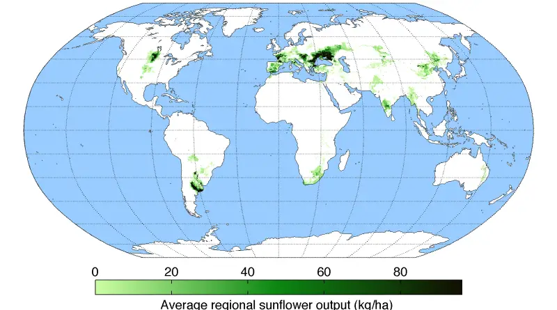
The sunflower was first domesticated in Mexico around 2600 BC. Many indigenous American peoples used the sunflower as the symbol
Read More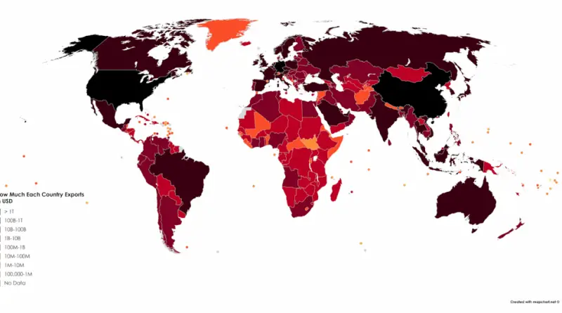
Reddit user: sendherhome22
Read MoreRelated post: – A collection of satirical maps of Europe
Read MoreTo which countries does the U.S. owe money and which countries owe the U.S. Source: titlemax.com Related post: – The Global
Read MoreGeorge Eastman Related post: – Mormons in the United States
Read MoreThere are hundreds of significant rivers in Europe. Some estimates suggest there are over 100,000 rivers and streams across the continent.
Read More
Reddit user: sendherhome22 Related post: – What Does Each Country Export the Most to the United States?
Read More