The South American herb map
Relates posts: – The European herb map
Read MoreU.S. African American population, percent increase by county
Related posts: – U.S. population, percent increase by county – U.S. Hispanic population, percent increase by county – U.S. White
Read More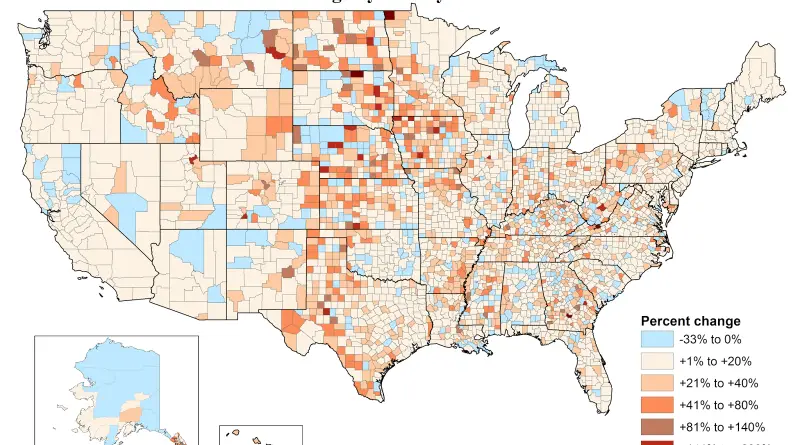
U.S. Indian American population, percent increase by county
Related posts: – U.S. Indian American Population under 5 years of age Percent Change by County (2010 – 2014) –
Read More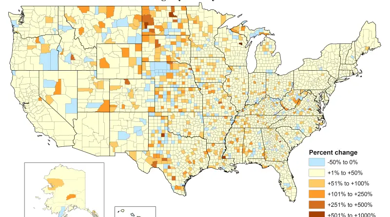
Asian American population, percent increase by county
Related posts: – U.S. Asian American Population under 5 years of age Percent Change by County (2010 – 2014) –
Read More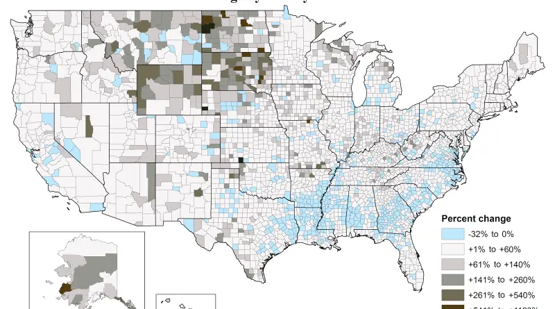
U.S. African American population, percent increase by county
Related posts: – U.S. population, percent increase by county – U.S. Hispanic population, percent increase by county – U.S. White
Read MoreGlobal Agewatch Index
The Global AgeWatch Index provides an analysis of results by region. It measures four key domains for older people, covering
Read More