How Americans Heat Their Homes
A surprising journey through the hidden world of how Americans stay warm, revealing unexpected connections between energy, landscape, and lifestyle.
Read more: How Americans Heat Their Homes
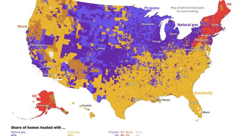
A surprising journey through the hidden world of how Americans stay warm, revealing unexpected connections between energy, landscape, and lifestyle.
Read more: How Americans Heat Their HomesPeople who spent their childhoods in liberal urban and coastal areas are about 10% less likely to get married before
Read more: How Your Hometown Affects Your Chances of Marriage in the USAmong the most important factors determining which plants can survive where is how cold the winter is. If you’re planting
Read more: Planting your spring garden? Consider climate’s ‘new normal’When we examine a United States map showing ethnic majorities at the county level, we uncover fascinating patterns that reflect centuries of migration, settlement, and cultural evolution. From the strong presence of African American majorities in the Southeast to the Hispanic-majority counties in the Southwest, each region tells a unique story of America’s diverse heritage.
Read more: An Ethnic Map of the United States by County MajorityHere’s Japan, Korea, Russia and China Alaska Western United States and Mexico South America Eastern Europe Northern Europe Western Europe
Read more: Fascinating Relief Map of the Earth, showing exaggerated mountain rangesMost Distinctive Causes of Death A. Tuberculosis B. Meningococcal infection C. Septicemia D. Syphilis E. Human immunodeficiency virus F. Other
Read more: The Most distinctive causes of death by state (2001-2010)Archaeological evidence shows that people have been in the Americas for at least over 12 thousand years. The population of
Read more: Percent Asian ancestry in North America144 largest U.S. counties have population: 159,524,138 (50.03% of total population). 2,998 smallest U.S. counteis have same population – 159,332,918
Read more: Territories of the US, sized by populationThirty-second animation of the changes in United States historical county boundaries (1629 – 2000). Historical state and territorial boundaries are
Read more: Animated history of US county boundaries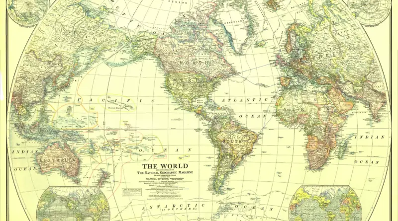
The zenith of western imperialism. Political map of 1922 The British Empire was at its peak The largest and most
Read more: All the land under European control in 1922Click on the map to define the origin and destination of your trip. In addition to the shortest route, two
Read more: Clean Ride MapperGlobal Peace Index measures the relative position of nations and regions peacefulness. The Global Peace Index gauges global peace using
Read more: Global Peace Index1. FAR NORTH! Geography: Larger than Utah, Indiana, and Maryland combined. Or a bit larger than Germany. Mostly uninhabited tundra,
Read more: Regions of Alaska