Most Populous Combined Statistical Areas in the U.S.
Combined Statistical Areas represent multiple metropolitan or micropolitan areas that have an employment interchange of at least 15 percent.
Read More
Combined Statistical Areas represent multiple metropolitan or micropolitan areas that have an employment interchange of at least 15 percent.
Read More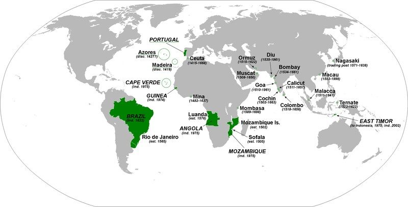
The Portuguese Empire was one of the biggest and longest-lived empires in world history; it existed for nearly 6 centuries, from the capture of Ceuta in 1415 to the handover of Portuguese Macau to China in 1999. The Second Portuguese Empire spanned 5.4 million square kilometers or 2.12 million square miles at its peak.
Read More
Job openings in healthcare, community services, and STEM (science, technology, engineering, and mathematics) will grow the fastest among occupational clusters. American adults hold approximately 16.7 million bachelor’s degrees in science, technology, engineering, and mathematics (75 degrees per 1,000).
Read More
64.8% of the United States population is of working age (15-64 years). In percentage terms, America’s working-age population achieved its highest rate in 2006 and 2007, when 67.3% of the American population was of working age. Over the last decade, the increase of the non-working-age population — ages 0 to 14 and 65 and older — has exceeded the growth of the working-age population.
Read More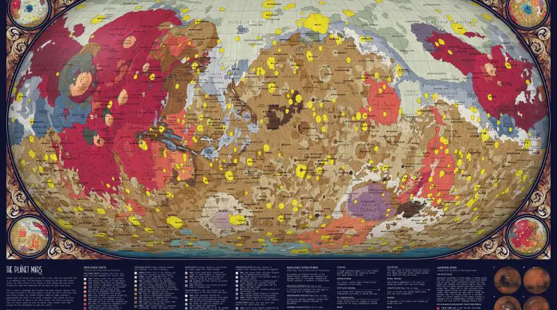
Mars is home to dizzyingly tall mountains and deep canyons. Olympus Mount is the tallest mountain in the Solar system. It’s about two and a half times taller than Mount Everest.
Read More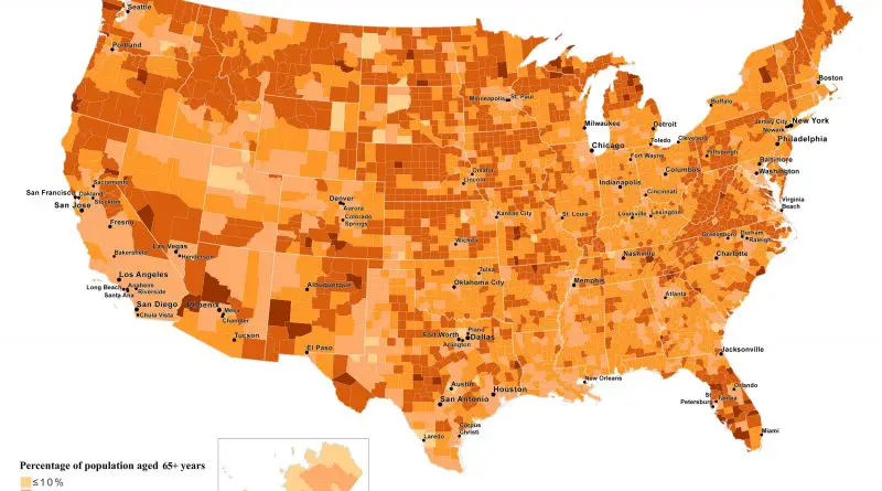
The population aged 65 and older in the United States is 54.1 million. They represented 16 percent of the population, more than 1 in every 7 U.S. citizens. The number of older Americans has grown by 14.4 million (or 36%) since 2009, compared to a rise of 3 percent for the under-65 U.S. population.
Read More
Carthage was the capital city of the ancient Carthaginian civilization, located between the Tunisian capital city of Tunis and the Gulf of Tunis. Among the ancient world’s largest and prosperous cities, Carthage’s strategical position gave access to extensive fertile lands and major marine trade ways.
Read More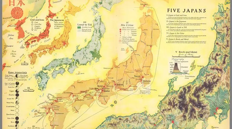
Japan first became known to Europeans through the account of Marco Polo at the close of the thirteenth century. Marco Polo had never been to Japan, but he had his information from the Great Khan.
Read More
The historic probability of there being at least a tenth of an inch of rain on July 4 is based on observations from 1981 to 2010.
Read More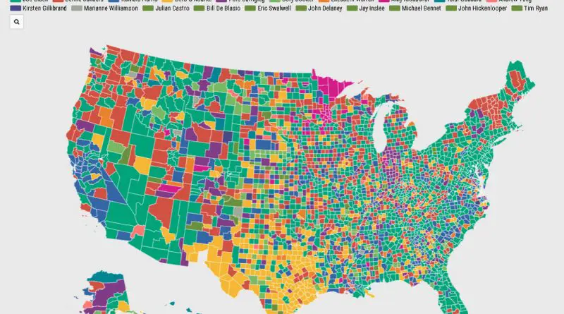
Joe Biden was the most searched candidate in all but seven U.S. states on Google, accounting for 27.7% of search traffic.
Read More