How Many Ways Can You Divide Finland?
How do you divide Finland? Not just by region — but by warning signs, tree cover, and whether the sun even rises in winter.
Read more: How Many Ways Can You Divide Finland?

How do you divide Finland? Not just by region — but by warning signs, tree cover, and whether the sun even rises in winter.
Read more: How Many Ways Can You Divide Finland?
A visual tour of Italy’s most recognizable brands reveals more than just logos; it also reveals the distinctive fusion of innovation, tradition, and style that powers some of the most adored businesses in the world.
Read more: Map of Most Valuable Italian Brands
Canada’s not provinces and territories—it’s hockey zones, weather extremes, and political opposites. These quirky maps divide the country up in ways that’ll make you laugh and think.
Read more: Tearing Canada apart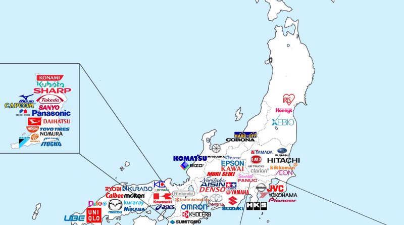
Map of Japan picks out the headquarters of its most valuable brands, offering a new perspective on the economic geography and regional brand distribution of the nation.
Read more: Mapping Japan’s Brand Landscape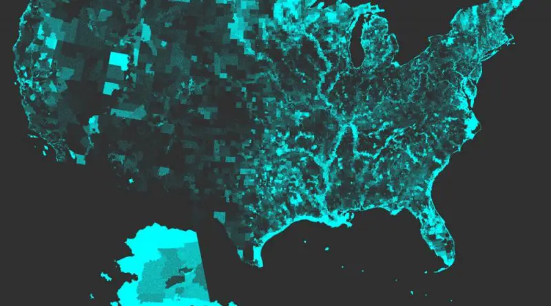
States like Michigan have an abundance of water resources, while others like New Mexico have very little. This is revealed by a thorough analysis of U.S. Census Tracts. This distribution affects the quality of the water and presents problems for water management in the future.
Read more: Water Area per U.S. Census Tract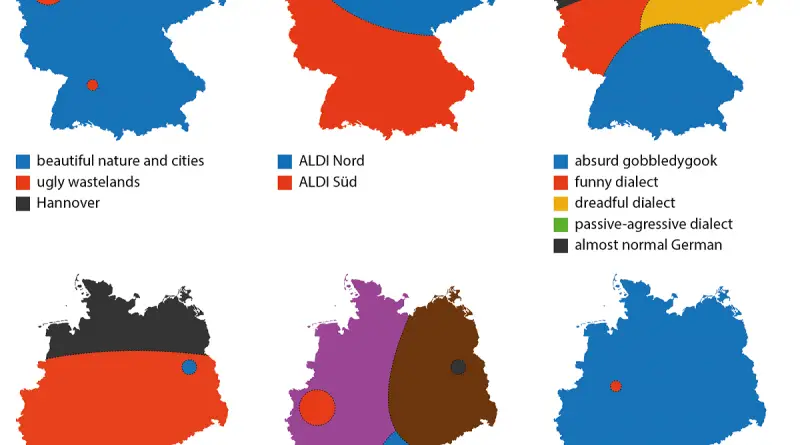
How do Germans split up their own nation? These 20 ingenious maps illustrate the numerous unofficial lines that influence life in Germany and Bavaria.
Read more: Tearing Germany apart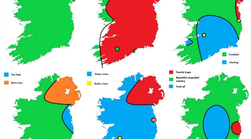
Ireland might look like one island on the map, but culturally? It’s a wild patchwork of identities. These clever satirical maps show just how many Irelands there really are—and what makes each one tick.
Read more: Tearing apart Ireland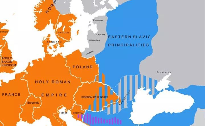
A look at the historic divide in Christianity that shaped Europe and beyond. Here’s what happened in 1054—and what often gets left out.
Read more: Christianity in 1054: East, West, and the Forgotten Paths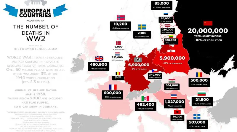
An in-depth analysis of World War II’s unprecedented human cost, examining the conflict’s impact across continents through compelling maps and historical data.
Read more: World War II’s Human Toll: A Global Tragedy in Numbers and Maps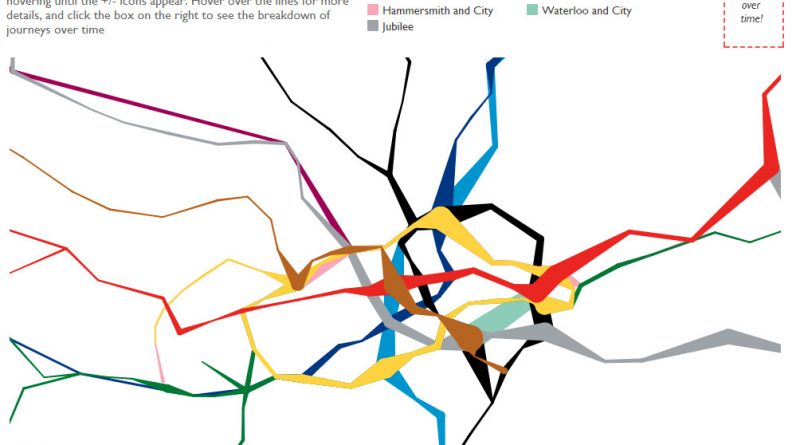
Ever wondered where people actually get on and off the London Underground? This fascinating data visualization maps it out with real passenger data, offering insights into the city’s busiest stations and the hidden geography of movement beneath London.
Read more: Where do passengers get on and off the London’s tube?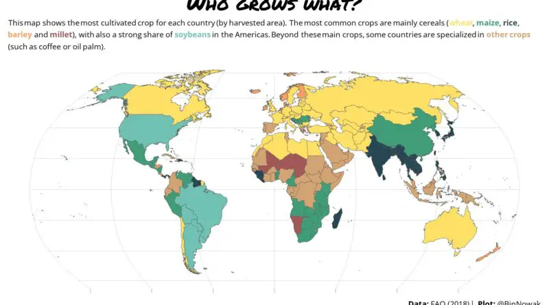
The most popular crops in the world vary by region and climate, but globally, staples like wheat, rice, and maize (corn) are among the most widely cultivated.
Read more: World Map of the Most Cultivated Crop in each Country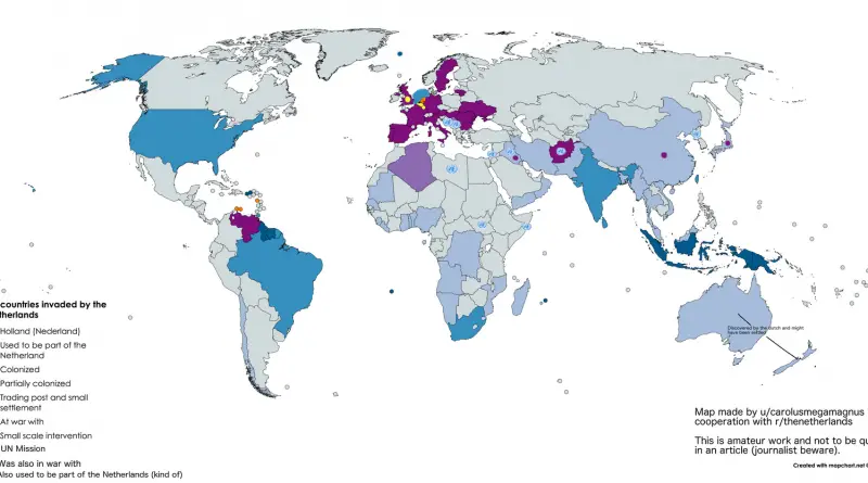
How did such a small country reach so many parts of the world? A historical map shows the global footprint of Dutch expansion — from colonial outposts to trade wars.
Read more: All countries “invaded” by the Netherlands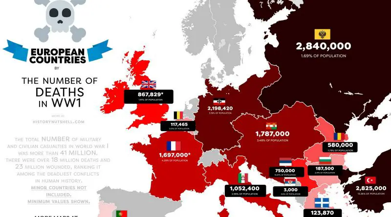
Examining the devastating toll of WWI through carefully curated maps and data, showing how military casualties and subsequent food shortages transformed the European continent.
Read more: The True Cost of World War I