Continents with Economy Smaller than Japan
A 2017 map shows something surprising: Japan’s economy was bigger than South America’s, Africa’s, or Oceania’s.
Read more: Continents with Economy Smaller than Japan
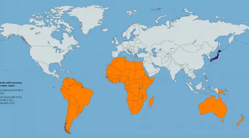
A 2017 map shows something surprising: Japan’s economy was bigger than South America’s, Africa’s, or Oceania’s.
Read more: Continents with Economy Smaller than Japan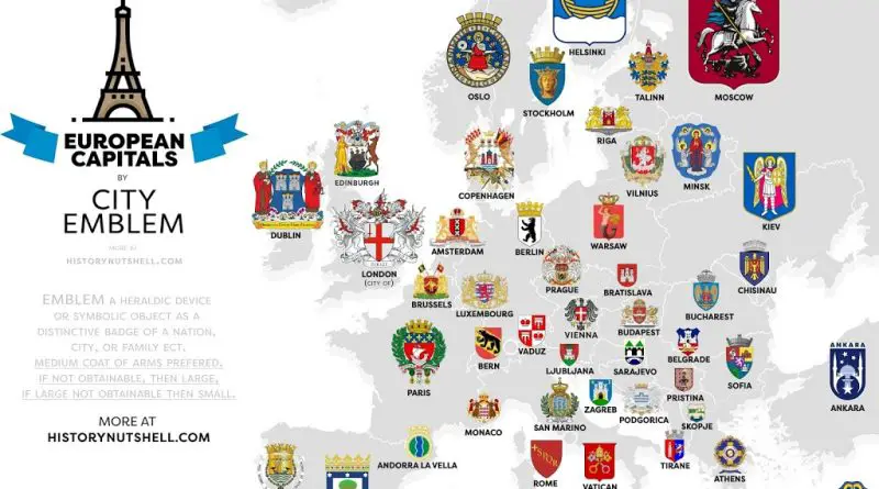
Across Europe, coats of arms are more than decoration. They’re snapshots of local pride and long history—knights’ shields turned into national and city symbols that still evolve today.
Read more: From Lions to Towers: The Stories Behind Europe’s Coats of Arms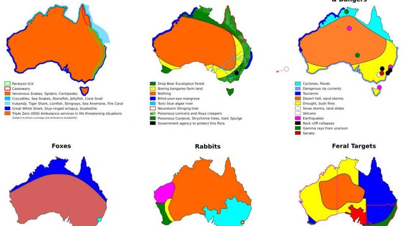
These satirical maps of Australia mix playful exaggeration with familiar truths – covering everything from sports allegiances to venomous creatures.
Read more: Tearing Australia apart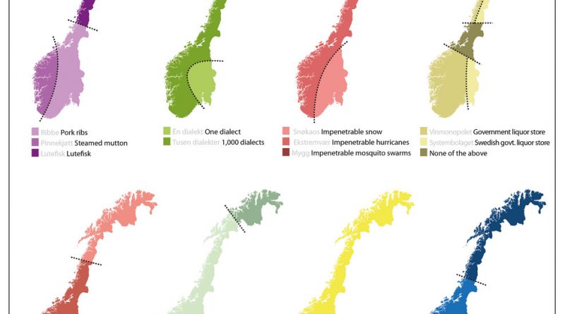
Norway gets carved into eight versions of itself—based on food, dialects, weather, and even drinking culture. A satirical take on borders that mixes exaggeration with truth.
Read more: Tearing Norway apart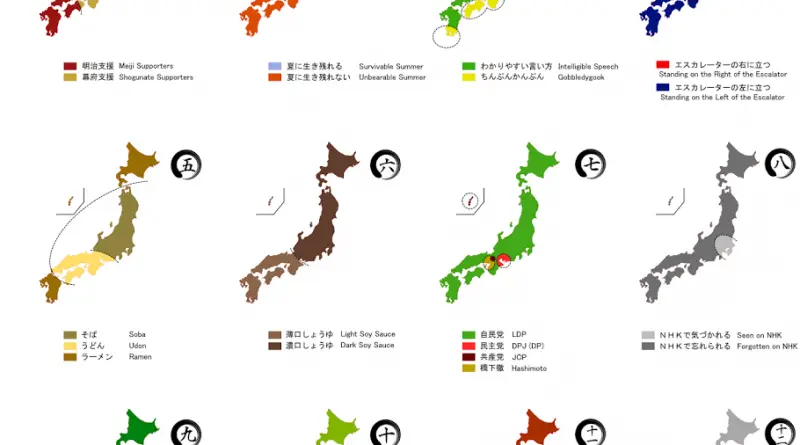
Japan is one of the unique nations. As an island country with a long history of geographical and political isolation, many cultural features are formed utterly untouched by external influences. Moreover, Japan has never been colonized by other countries.
Read more: Ways to divide Japan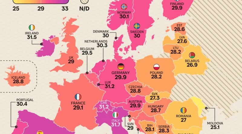
Generations ago, it was common to marry young and start a family soon after. Today, many women delay motherhood into their 30s. What changed—and what does it mean?
Read more: Mean age of women at birth of the first child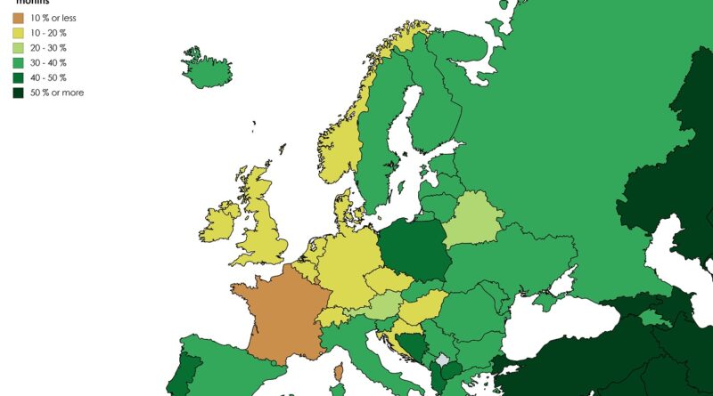
Alcohol consumption patterns vary dramatically worldwide, but what about the people who don’t drink at all? This animated map visualization explores two decades of data showing how abstinence rates changed across different countries and cultures.
Read more: Percentage who have not Consumed Alcohol in the last 12 Months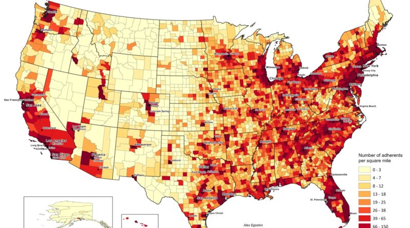
Based on ARDA’s 2020 U.S. Religion Census, about 161 million Americans are counted as religious adherents. This map shows where they’re most concentrated by land area, and an animation traces changes since 1890.
Read more: Religious Adherent Density by U.S. County (1890 – 2020)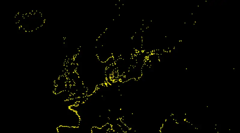
Europe’s coasts are dotted with lighthouses that combine history, engineering, and navigation. This post presents a map of their locations, highlights the oldest examples, and compares the tallest lighthouses across the continent.
Read more: Lighthouses of EuropeSource: facebook.com A tax wedge or tax on labor is the difference between before-tax and after-tax wages. The tax wedge
Read more: European countries by total burden on labor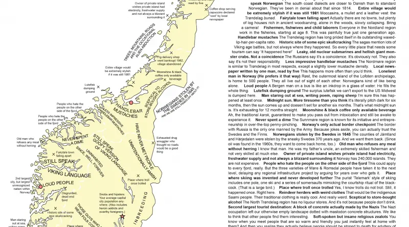
Norway isn’t just fjords and Vikings. This map shows how people describe their own regions—with pride, teasing, and plenty of humor. It’s a down-to-earth look at local life that goes beyond scenery and history.
Read more: Map of the kingdom of Norway and it’s regional stereotypes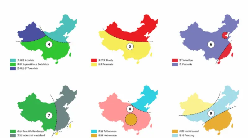
China is the biggest of all Asian nations and has the largest population of any country globally. Occupying almost the entire East Asian landmass, it comprises about 1/14 of the land area of Earth. Among the world’s influential nations, China is exceeded in size by only Russia and Canada, and it is approximately as big as the entire of Europe.
Read more: Tearing China apart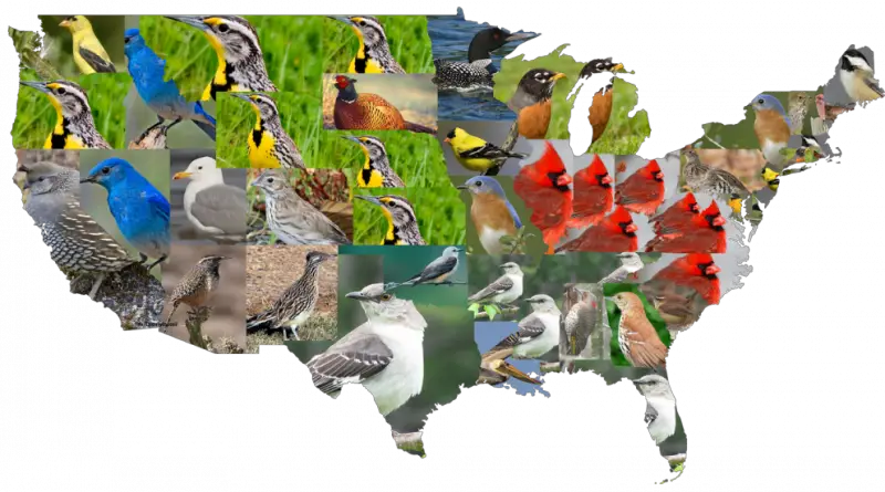
The United States is home to more than 1,100 bird species. Many states have chosen one of these birds as their official symbol. See the complete list of state birds and how they reflect the country’s rich wildlife.
Read more: Official Birds of the United States