United States
Maps of the US
Number of U.S. counties with high levels of inequality & poverty has increased over time
In 1989, 11 percent of large metropolitan counties suffered from high levels of inequality, In 2014 – 21 percent. The
Read MoreAmerican nations
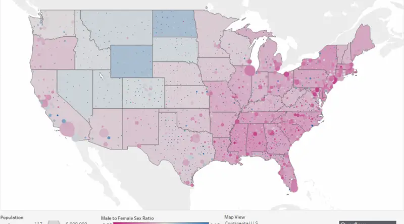
The July 4, America celebrates independence from Great Britain. During that time, the United States was split into 13 separate colonies, which later developed and extended into the 50 U.S. states we have nowadays. But America isn’t only made up of 50 states. It may also be a nation composed of many tribes. This can be used as a basis for the cultural divisions of America into regions.
Read MoreGlaciers in Alaska’s National Parks
Glaciers are a central component of the visitor experience in Alaska. Most of Alaska’s glacier- covered area lies within national
Read More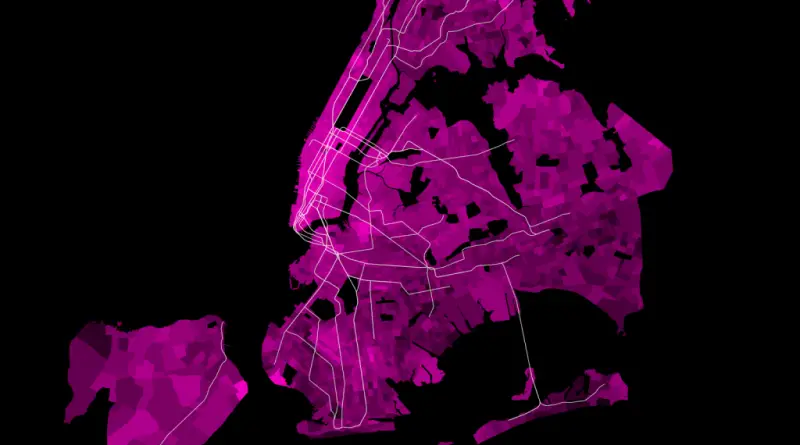
NYC average work commute times
Average Work Commute Times for New York City Residents. Via www.nickusoff.com Related posts: – New York’s Subway Deserts –
Read More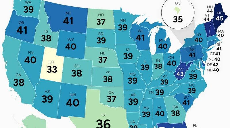
Mapped: U.S. Median Age by State
Maine and Utah are separated by 12 years in median age. Since 2000, New Hampshire added 6.5 years while North Dakota added barely half a year. Where young people choose to live makes all the difference.
Read MorePipeline Spills in the U.S. (1986 – 2016)
In the last 30 years, there have been over 8,700 liquid pipeline spills in the Unites States (nearly one every
Read MoreTreepedia: Mapping Urban Trees in U.S. Cities
Understanding and promoting urban tree cover has never been more important Increasing a city’s tree canopy contributes to lowering urban
Read More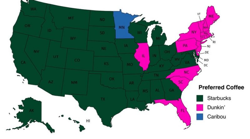
The most common coffee chain and the number of coffee shops per 100,000 in each U.S. state
Which coffee shops has the most locations per U.S. state Starbucks is the most popular coffeehouse in the United States.
Read More