Animated maps
Hurricane Matthew’s water footprint
Hurricane Matthew approached the southeastern United States coast on October 7, 2016. In the map above, the hurricane’s impact on
Read More
Wi-Fi codes of airports around the world
Interactive map gives wireless passwords from airports & lounges. Offline version of this map: iOS, Android.
Read More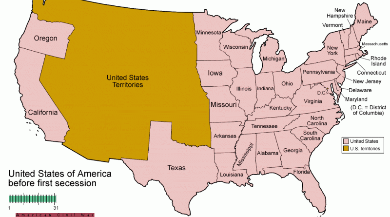
Evolution of U.S. States with a focus on the Confederate States (December 20, 1860 – July 15, 1870)
Related posts: – USA boundary evolution – Territorial evolution of North America of non-native nation states from 1750 to 2008
Read More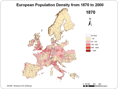
European population density (1870 – 2000)
Related post: – Projected change in European population between today and 2080
Read MoreUninsured rate by U.S. State (2008 – 2014)
Population without health insurance coverage. Via census.gov Related posts: – Percentage of Americans in 2015 who do not have health insurance
Read More
Climate maps
Climatemaps is an interactive map of global monthly mean climate data from land observations between 1961 and 1990. Temperature Precipitation
Read More
Counties with fewer than 25 black Americans (2010 – 2014)
Counties with fewer than 25 black Americans, 2010 Counties with fewer than 25 black Americans, 2014 Related posts: – Counties with
Read More