Higher than Ben Nevis (the highest point in the UK)
Via stevefaeembra
Read More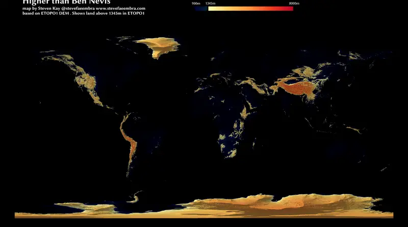
Via stevefaeembra
Read More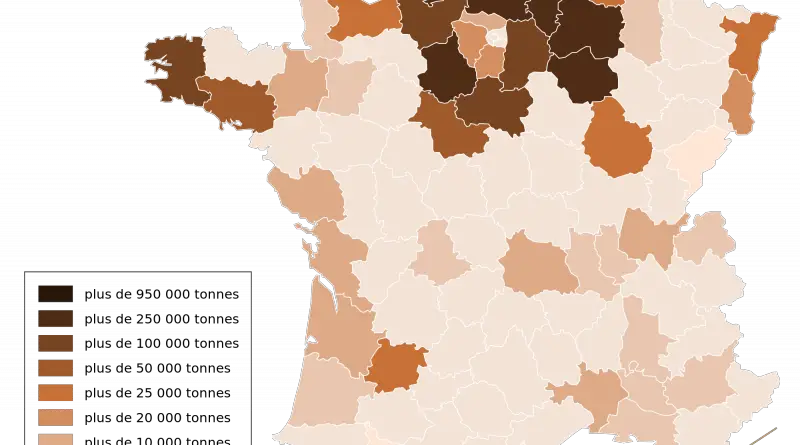
there are almost half a million farms in metropolitan France and 25 thousand in overseas territories. It represents a utilized agricultural area of nearly thirty million ha, more than 50% of the French area. This territory is split into three significant crops: 63 percent of cropland (cereal and forage crops mainly), 34 percent of grassland, and 3 percent of perennial crops, orchards, and vineyards.
Read MoreVia bl.ocks.org
Read MoreVia nytimes.com Related posts: – Uninsured rate by U.S. State (2008 – 2014) – Uninsured rate by U.S. County (2008
Read MoreThe land surface temperature calculated by using a satellite imagery (August 24, 2016 at 4:0 3PM) and by doing some
Read More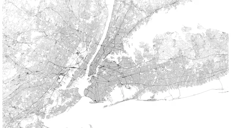
Related posts: – New York’s Subway Deserts – New York City boroughs journey to work-driving ca alone vs. walk/public transportation
Read MoreHeat map of OSM Activity around the world.
Read More