
Mapping
Global cities at risk from sea level rise
Climatecentral.org developed special KML layers corresponding precisely to the elevated global sea surfaces projected to inevitably occur after 2°C or
Read more: Global cities at risk from sea level risePathways
There are 7.9 billion mobile-connected phones on the earth right now, and you probably have at least one of them.
Read more: PathwaysBendy Map
A horizonless map made with Tangram, in the spirit of Inception and the BERG Here & There map.
Read more: Bendy MapU.S. population density shown in Google Earth
U.S. population density map The height of each state represents the population density while the volume of the figure represents
Read more: U.S. population density shown in Google Earth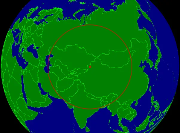
The farthest place on Earth
The farthest place on Earth from land The farthest place on Earth from ocean
Read more: The farthest place on Earth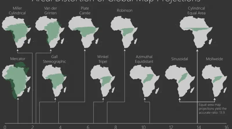
Areal Distortions of Global Map Projections
MercatorA cylindrical map projection presented in 1569 by the Flemish geographer Gerardus Mercator. It became the standard map projection for
Read more: Areal Distortions of Global Map ProjectionsWhat every country in EU is best at
What every country in EU is best at: Austria – Lowest unemployment Belgium – Most Recycling Bulgaria – Cheapest electricity
Read more: What every country in EU is best atWhat’s on the other side of the ocean?
The map below shows the countries that are due west and east from points along the coasts of the Americas.
Read more: What’s on the other side of the ocean?