Old maps
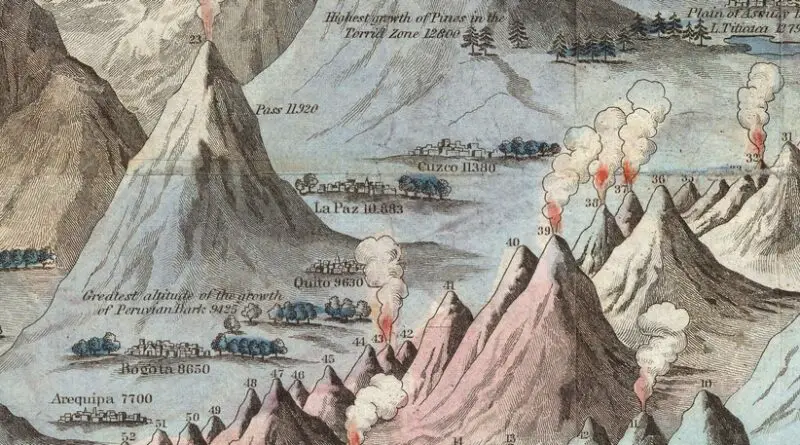
Historical infographic maps comparing the world’s mountains and rivers
Nowadays, detailed information about any geographical object on our planet can be got in just a few seconds. But two centuries ago, life was radically different. That’s why comparative infographic maps were viral in the 19th century, which allowed people to get information about the main geographical objects of our planet.
Read MoreNewark – New Jersey (1916)
Bird’s eye view of Newark, New Jersey with the Manhattan skyline in the background, 1916. Via loc.gov
Read More
Worldmap from 1402 made in Korea
Honil Gangni Yeokdae Gukdo Ji Do
Read MoreBird’s-Eye Map of Greater New York (1897)
“First Bird’s-Eye Map of Greater New York”. From photographs taken in the Sunday World’s Sudio Balloon, April 29, 1897. Issued
Read MoreAustralia’s First Map (1547)
Australia’s First Map from Nicholas Vallard’s manuscript sea atlas, showing Jave La Grande’s east coast (1547). https://c1.staticflickr.com/9/8610/27594219154_11159fc1ea_o.jpg
Read More