World population density
This exploratory map shows data from the fantastic Global Human Settlement Layer (GHSL) produced by the European Commission. Integrating huge
Read more: World population density
This exploratory map shows data from the fantastic Global Human Settlement Layer (GHSL) produced by the European Commission. Integrating huge
Read more: World population density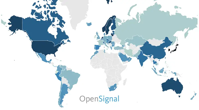
This map shows how consistently accessible 4G networks are in each country. Rather than measure geographic coverage, OpenSignal’s availability metric
Read more: 4G/LTE Availability (2016)Youth development can be achieved even in lowincome countries by providing quality education and training and allowing young people to
Read more: Youth Development Index 2016 (2016)The Basel Anti-Money Laundering (AML) Index is an annual ranking assessing country risk regarding money laundering/terrorism financing. It focuses on
Read more: Basel Anti-Money Laundering Index by CountryVia worldpolicycenter.org
Read more: Countries with Guaranteed Paid Sick LeaveReddit user: q1s2e3
Read more: New England Stereotypes Map
Overall in the nation, Park is the most popular street name. But Dogwood and Magnolia reign in the South, while
Read more: The most popular street names in each U.S. state
This interactive map builds on the global infrastructure networks depicted in Parag Khanna’s 2016 book “Connectography – Mapping the Future
Read more: Exploring the world of Connectography