Skip to content
VividMaps

  • Atlases
  • Map Posters
  • Scratch Maps
  • Globes
  • Videos
Ethnic mapsPolitical mapsSliderWorld
August 1, 2017 Alex

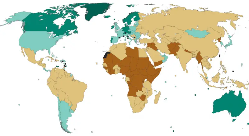
Fragile State Index (2017)

Source: epatrono The Fragile States Index is an annual report published by the U.S. think tank, the Fund for Peace

Read more: Fragile State Index (2017) →

EntertainmentInteractive maps
August 1, 2017 Alex

London map of the movie filming locations

London has been a host to thousands of movie sets. This map displays where what movie and what scene has

Read more: London map of the movie filming locations →
Historical Maps
July 31, 2017 Alex

The Anglo-Saxon Kingdoms, CA. 800

Reddit user: ThorPL123

Read more: The Anglo-Saxon Kingdoms, CA. 800 →
World
July 31, 2017 Alex

11-12 th century trade routers

Even before modern times, the Afro-Eurasian world was already well connected. This map depicts the main trading arteries of the

Read more: 11-12 th century trade routers →
JobTerrorism
July 30, 2017 Alex

The most distinctive jargon in US job listings

textio.ai The full list of US states & their most distinctive cliches: Alabama – Value add Alaska – Corporate values

Read more: The most distinctive jargon in US job listings →
Economic mapsResourcesSlider
July 30, 2017 Alex

States of Brazil compared to countries of similar GDP

Reddit user: vonsenke

Read more: States of Brazil compared to countries of similar GDP →
World
July 29, 2017 Alex

Highest points of European countries

Reddit user: dobik

Read more: Highest points of European countries →
Economic mapsMapping StereotypesNature
July 29, 2017 Alex

India states compared to countries of similar GDP

Reddit user: thegeneralx

Read more: India states compared to countries of similar GDP →
Economic maps
July 29, 2017 Alex

Provinces of China compared to countries of similar GDP

Reddit user: thegeneralx

Read more: Provinces of China compared to countries of similar GDP →
Crime mapsGoogleInternetMapping Stereotypes
July 28, 2017 Alex

Deep philosophical and religious questions most Googled by each US state

Questions and terms related to life, morality and religion each US state Googled more than any other state in the

Read more: Deep philosophical and religious questions most Googled by each US state →
Internet
July 28, 2017 Alex

Most Instagrammed Places (2016)

The most Instagrammed places in the world are Disney Theme Parks, Universal Studios Theme Parks, Central Park in New York

Read more: Most Instagrammed Places (2016) →
Ethnic mapsHistorical MapsInteractive maps
July 28, 2017 Alex

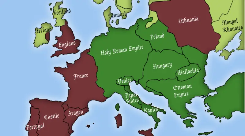
European countries where Jews were allowed to exist in 1500

“The role that Christian dogmatism played should not be underestimated. Most of Europe was devoutly Christian right up until the

Read more: European countries where Jews were allowed to exist in 1500 →
Environment maps
July 28, 2017 Alex

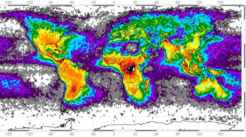
Frequency of Lighting strikes

Global frequency of Lighting strikes U.S. frequency of Lighting strikes Lightning density map showing total lightning from 2015-2019. The National

Read more: Frequency of Lighting strikes →
Page 131 of 521« First«...127128129130131132133134135...»Last »

Trending now

  • Soviet detailed map
    Detailed Cold War-era Soviet military map of the San Francisco Bay area (1980)Oct 22, 2017
  • Human races of the 19th century
    How Has Our View of Human Diversity Changed Since the 19th Century?Oct 22, 2017
  • World map of Y-DNA Haplogroups
    World map of Y-DNA HaplogroupsMay 17, 2017

Related Products

  • Push pin maps
  • Globe drinks cabinets
  • Maps of the United States
  • Board games
  • Monopoly
  • Map-based strategy board games
  • History Board Games
  • Coloring Books
  • Handheld GPS
  • GPS Watches
  • GPS Trackers

Vivid Maps Tools

  • Convert Latitude/Longitude
  • Elevation Finder
  • Distance Calculator
  • Kilometers to Miles Distance & Length Converter
  • Weight Converter
  • Volume Converter
  • Daylight Comparison
  • Time Zone Converter
  • Antipodes Map
  • Find cities with a similar climate
  • Find cities with a similar climate (2050)
  • How hot cities could be in 2050
  • The U.S. Population Lines

Stay connected

Get the latest maps, insights and updates delivered to your inbox.

Unsubscribe anytime.

VividMaps

Maps that explain the world.

Beautiful, data-rich maps to help you understand our world — its people, places and connections.

Explore

World map World atlas Map posters Globes

Company

About Privacy Contact

Stay connected

Follow us for the latest maps, insights and updates.

Independent WebsiteVirusScanner trust report for vividmaps.com
© 2026 Vivid Maps. All rights reserved.
A more connected world