Which Countries Still Have Official State Religions?
Twenty-seven countries maintain official state religions in 2025. Islam dominates North Africa and the Middle East, Christianity persists in parts of Europe, Buddhism in Southeast Asia.
Read More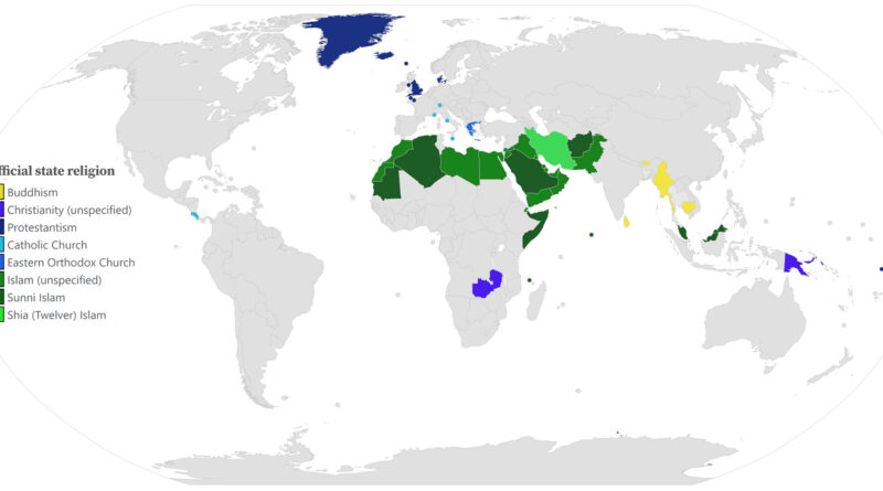
Twenty-seven countries maintain official state religions in 2025. Islam dominates North Africa and the Middle East, Christianity persists in parts of Europe, Buddhism in Southeast Asia.
Read MoreRenewables now generate about a quarter of America’s electricity. But that power doesn’t come from everywhere equally. Some regions have incredibly rich sun and wind resources, while others get far less.
Read More
In 1938, the year before WW2, the United States had, by far, the largest economy worldwide in terms of GDP. The 5 Allied Great Powers that arose victorious from the war and the 3 Axis Tripartite Pact nations that were eventually defeated made up the 8 largest sovereign economies in 1938.
Read More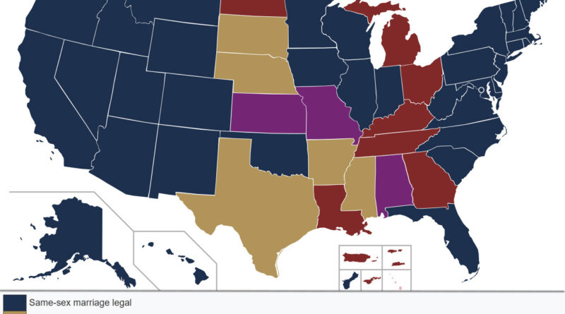
When the Supreme Court heard Obergefell v. Hodges in 2015, America’s map of marriage equality looked nothing like the uniform landscape we see today. Some states had recognized same-sex marriages for over a decade. Others held firm to constitutional bans. Between these extremes lay a complex middle ground of legal limbo, stayed court decisions, and jurisdictional uncertainty. Understanding this geography helps us grasp just how fractured the legal landscape had been.
Read More
During the last ice advance and retreat (in the latest Pleistocene), an extension of the Cordilleran ice sheet called the
Read More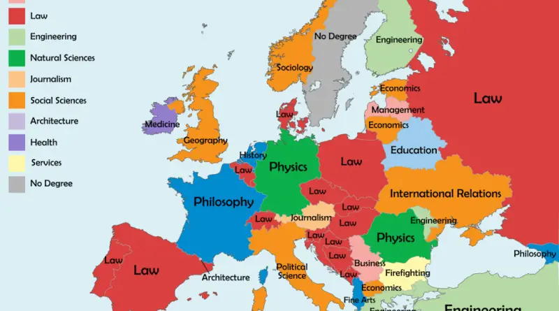
Law dominates this map of European leaders’ first university degrees, but it’s far from the whole story. Physics, Philosophy, Engineering, Medicine, Architecture all have their representatives, scattered across the continent in ways that reflect each country’s own academic and political culture.
Read More
When we think of Thanksgiving sides, a mixture of dishes may come to mind, from tasty dishes like macaroni and cheese and mashed potatoes to more delicious choices like cranberry sauce and cornbread. But when it comes to the most beloved Thanksgiving side of each U.S. state, tastes vary.
Read More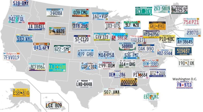
Wyoming has kept the same cowboy emblem on its license plate every year since 1936. Delaware’s current design dates to 1959. Mapped across all 50 states, these small metal rectangles carry more history than most people expect.
Read More
Catholics lead the Northeast and Southwest, Southern Baptists fill the South, Mormons built their base in Utah, and Lutherans define the Upper Midwest. Each concentration traces back to immigration corridors, evangelical revivals, or planned settlements from centuries ago.
Read More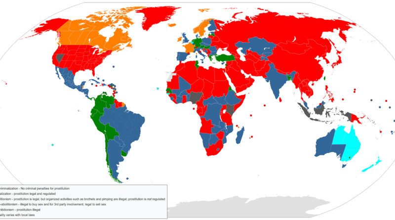
Ancient Rome taxed it and issued licenses for it. The Sumerians wrote about it on clay tablets in 2400 BCE. And yet in 2024, the world still runs six completely different legal frameworks for prostitution at the same time — ranging from full decriminalization in New Zealand to the death penalty in some jurisdictions.
Read More