U.S. States labelled as countries with the similar prison population
Related post: – Jail incarceration rate per 100,000 U.S. county residents
Read MoreRelated post: – Jail incarceration rate per 100,000 U.S. county residents
Read MoreCompiled from information furnished by the United States Forest Service. Related post: – U.S. Vegetation Map (1970)
Read Moretaxfoundation.org Top Ten Counties for State & Local Deductions 1. New York County, NY – $24,8982. Marin County, CA –
Read MoreReddit user: whistlebug23 Data: pure-gas.org
Read More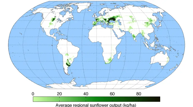
The sunflower was first domesticated in Mexico around 2600 BC. Many indigenous American peoples used the sunflower as the symbol
Read More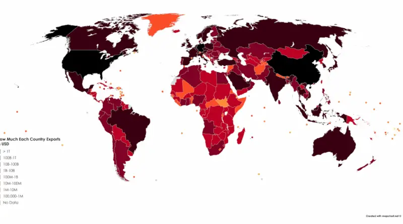
Reddit user: sendherhome22
Read MoreRelated post: – A collection of satirical maps of Europe
Read MoreTo which countries does the U.S. owe money and which countries owe the U.S. Source: titlemax.com Related post: – The Global
Read MoreGeorge Eastman Related post: – Mormons in the United States
Read MoreThere are hundreds of significant rivers in Europe. Some estimates suggest there are over 100,000 rivers and streams across the continent.
Read More