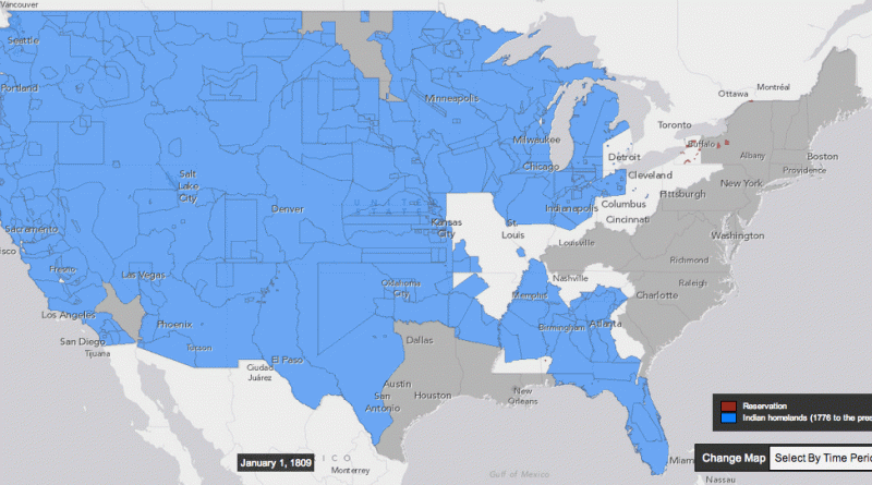
How the United States took more than 1.5 billion acres from native Americans
Between 1776 and 1887, the US seized over 1.5 billion acres from America’s indigenous people by treaty and executive order.
Read More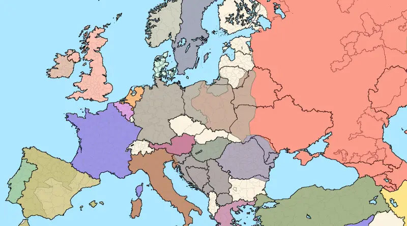
European borders in 1937 over current ones
Related post: – European borders in 1914 over current ones
Read More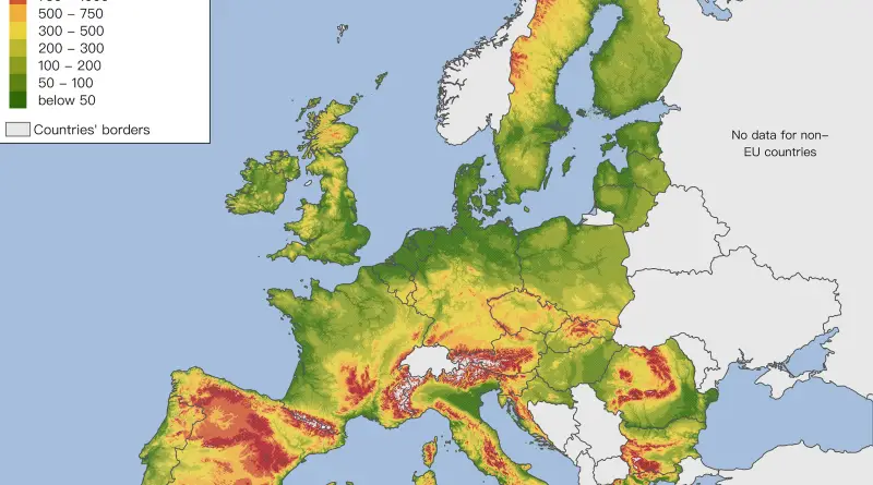
Elevation map of the European Union
You can clearly see how mountain ranges make up borders (except in Romania).
Read MoreGlobal Fishing Watch
Global Fishing Watch enables anyone with an Internet connection to see fishing activity anywhere in the ocean in near real-time.
Read More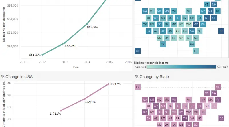
How has median household income in the United States changed since 2012?
Via overflow.solutions
Read More
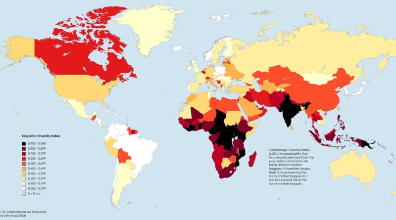
World Map of Language Diversity
Linguistic diversity is not merely a matter of different words for the same things but represents different ways of thinking about the world. It serves as a gateway to understanding diverse cultures, histories, and identities. However, this rich tapestry of languages is rapidly fading. Globalization and urbanization are leading to the extinction of many languages, resulting in a loss of unique cultural expressions and knowledge systems. Therefore, it is imperative to recognize, celebrate, and preserve linguistic diversity.
Read More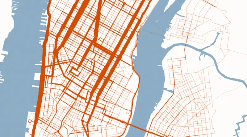
New York City bikeshare activity map (June 22, 2016)
Related posts: – New York Citi bike most popular roads (Sep – Nov 2015) – New York Citi Bike Rebalancing
Read More