Another way of looking at London
The whole area (including Greater London itself) contains 18.9 million people – more than a third of the population of
Read More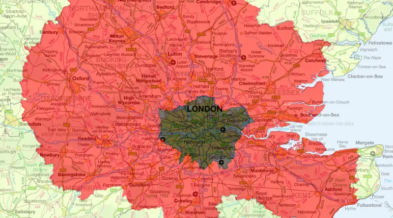
The whole area (including Greater London itself) contains 18.9 million people – more than a third of the population of
Read MoreVia finnaarupnielsen.wordpress.com
Read MoreManhattan, as the heart of New York City, is home to various iconic streets and neighborhoods, each with its own unique identity. Over time, certain stereotypes and perceptions have formed about these streets.
Read MoreMajor targets for nuclear bombs in the Soviet Union, part of planning a nuclear attack on the USSR (September 1945)
Read MoreRelates posts: – Google.ar autocomplete for Argentina: “Why is European country…?”
Read MoreRelated posts: – Jewish population by State (2015)
Read MoreSince 2008, about 198,500 unaccompanied minors have entered Europe seeking asylum, according to data from Eurostat, the EU’s statistical agency.
Read More