


Political stability & absence of violence
This map shows “Political stability & absence of violence”, a dimension of governances in Worldwide Governance Indicators (WGI) project by
Read More


This map shows “Political stability & absence of violence”, a dimension of governances in Worldwide Governance Indicators (WGI) project by
Read MoreVia metrocosm.com
Read MoreThe 10 largest US metro areas by GDP U.S. counties with GDP over $100 billion
Read MoreImaginary maps of the collapse of the Russian Empire.
Read MoreThe actual spread of the Aedes aegypti mosquito, according to various models. Countries with outbreaks, according to WHO and/or CDC,
Read MoreRelates posts: – Isochronic distances in days from London (1914) – Isochronic distances in days from London (1881) – A
Read More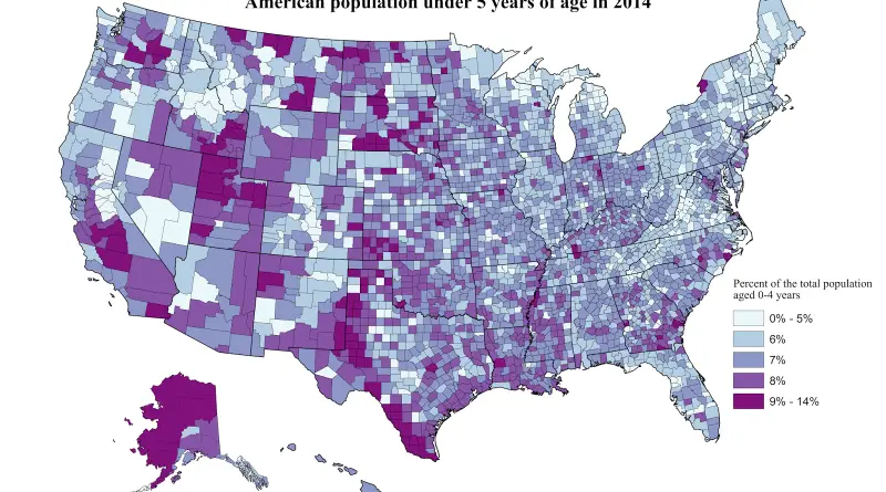
American population under 5 years of age in 2014 White non-hispanic population under 5 years of age in 2014 Hispanic
Read MoreThe map represents the proposal of the possible partition of Japan as a result of defeating Japan in the Second
Read More