U.S. Non-Hispanic White Population by County (1990 – 2017)
In 2011, for the first time in United States history, non-Hispanic whites accounted for under half of the births in
Read More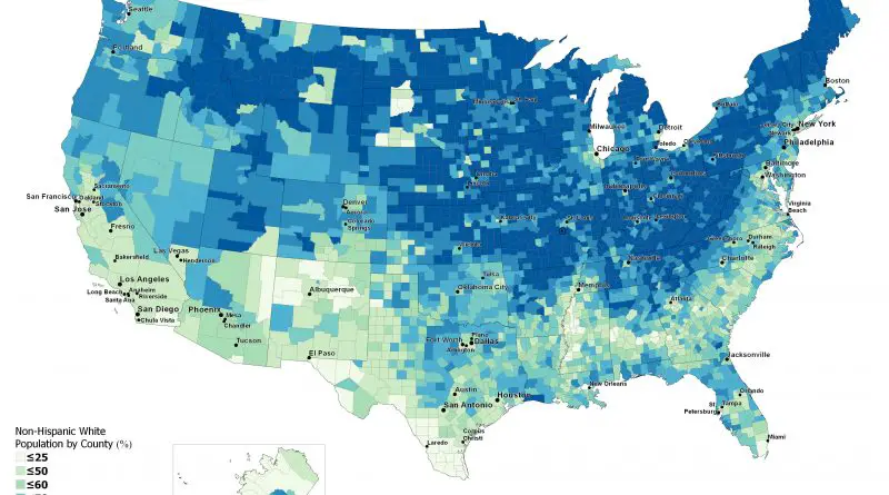
In 2011, for the first time in United States history, non-Hispanic whites accounted for under half of the births in
Read More
Explore the incredible diversity of California’s landscapes through the lens of the Paramount Studio map of 1927. Learn how this state can replicate regions like the French Alps, Siberia, the Sahara Desert, and more, making it a favorite for filmmakers around the world.
Read More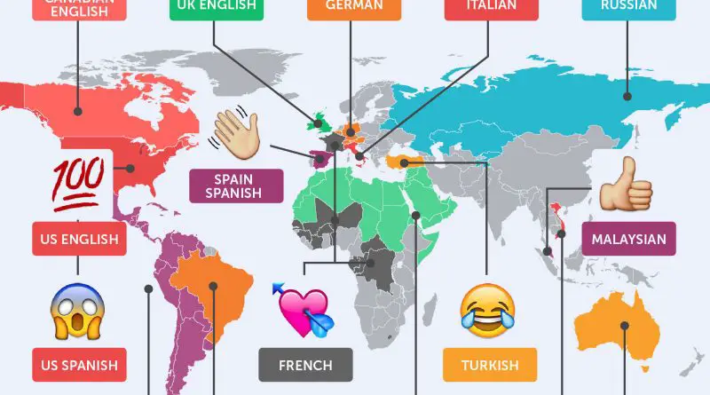
Dive into the world of emojis and uncover the most used emojis globally, their evolution since 1997, and the unique ways different countries use them. Learn how emojis have become a universal language in our digital communication.
Read More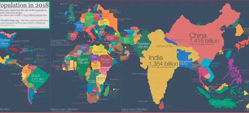
Explore a fascinating world map that reshapes countries based on population size, not land area. This unique cartogram offers a fresh perspective on global demographics, revealing surprising insights about our planet’s 7.633 billion inhabitants.
Read More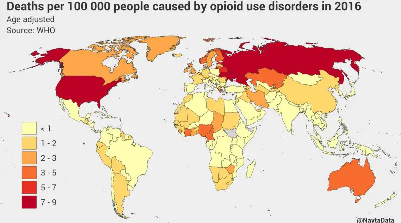
The world faces a severe opioid crisis, with countries like the US, Russia, and Ukraine experiencing high mortality rates. This article delves into the causes, demographics, and trends of opioid-related deaths, offering insights into global efforts to address this pressing issue.
Read More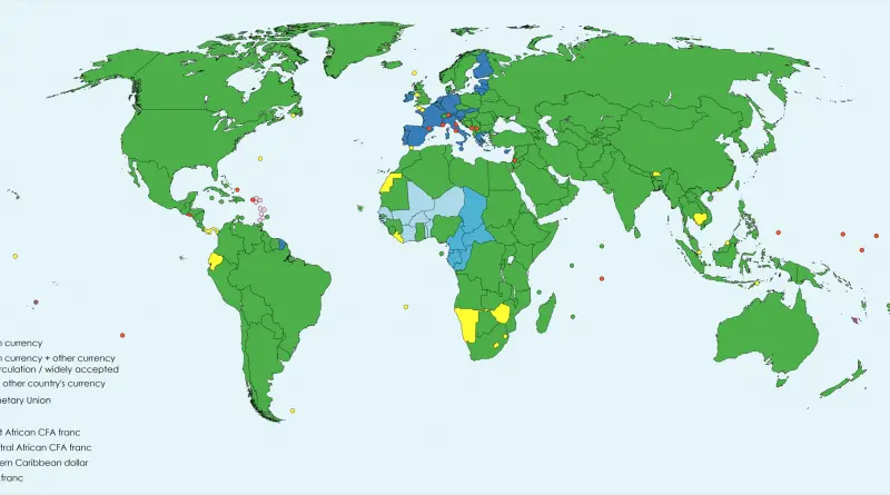
Currency usage by country varies worldwide, reflecting the diversity of economic systems, geopolitical factors, and historical developments. Each nation typically has its own official currency, serving as a medium of exchange, unit of account, and store of value. The choice of a national currency is influenced by factors such as economic stability, government policies, and international trade relationships.
Read More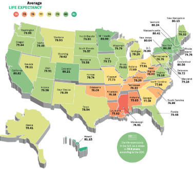
Life expectancy is determined as the average number of years that a person could expect to live if they experienced the age-specific mortality rates prevailing in a given nation in a select year. In 1930, life expectancy at birth in the United States was 58 for men and 62 for women. By 2001, the average U.S. life expectancy was 74 for men and 80 for women. In 2018 the average life expectancy was 80 years for males and 84 years for females.
Read More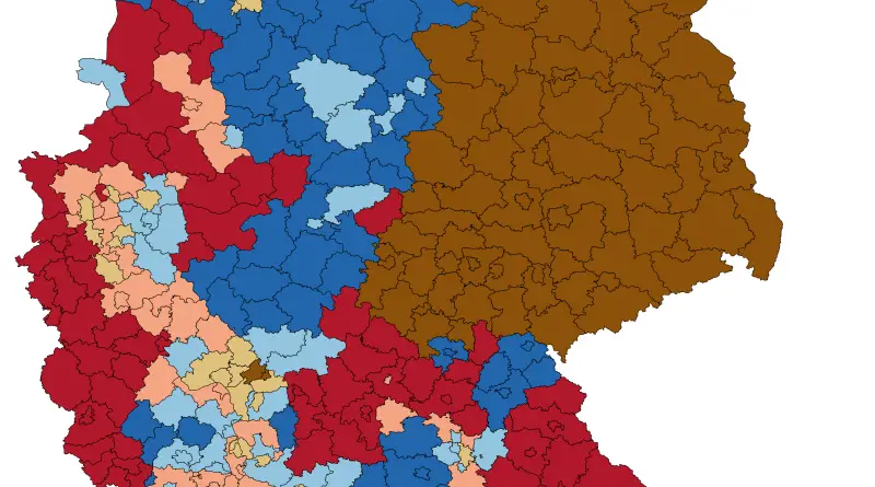
Christianity is the largest religion in Germany (58.5% of the population). The second-largest religion in Germany is Islam (5%). About
Read More
One thousand five hundred forty-three men and women have been executed in the U.S. since the 1970s, although executions have decreased dramatically over the past two decades. Most executions have been condensed to just a few U.S. states and a few outlier counties.
Read More
During the Ice Age, the sea level in Europe was significantly lower than it is today. The extensive ice sheets and glaciers that covered large parts of the continent locked up substantial amounts of water, causing the global sea level to drop.
Read More