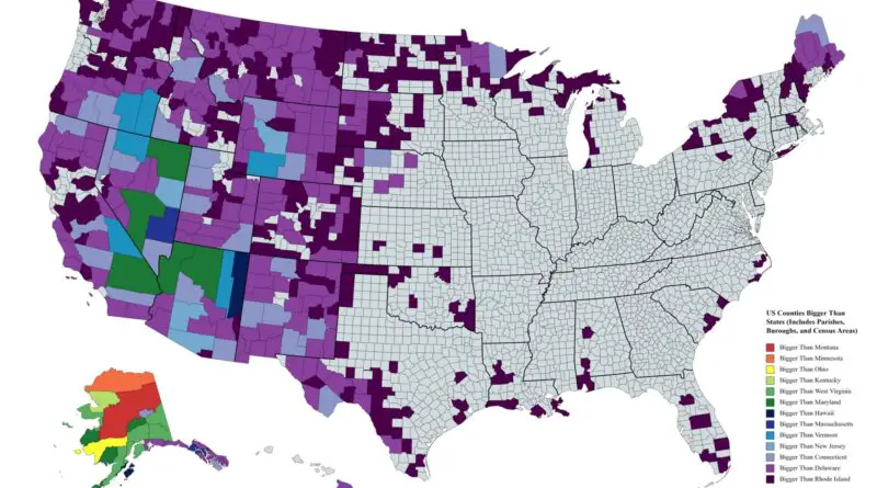
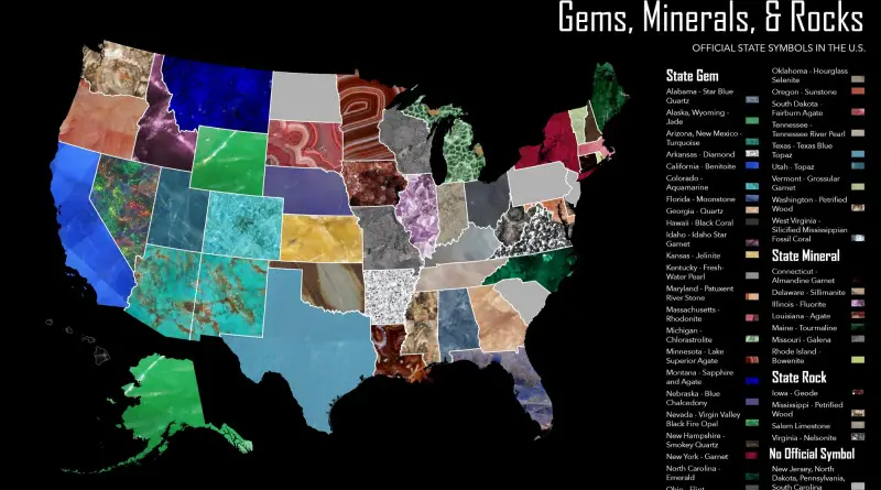
United States

Maps of the US

Historical Maps

Virginia’s Territorial Claims Over the Years

Virginia’s territorial claims have evolved significantly over the years, shaping the state’s geographic boundaries and influencing its historical narrative. The origins of Virginia’s territorial claims can be traced back to the early 17th century, when English settlers, led by the Virginia Company, established the Jamestown colony in 1607. The original charter granted by King James I defined Virginia’s boundaries as stretching from the Atlantic Ocean to the Pacific Ocean.

Read More
Environment maps

Autumn foliage colors mapped

Autumn foliage is a phenomenon that changes the green leaves of deciduous trees. By the end of October, yellow, orange, red, and brown varieties dominate, showing the coming of peak fall foliage in the western and northern U.S. When it comes to the end of November, all except the southern counties of the U.S. are past the peak point.

Read More