
Historical Maps
Historical maps showing territorial changes of countries and historical events of the past.
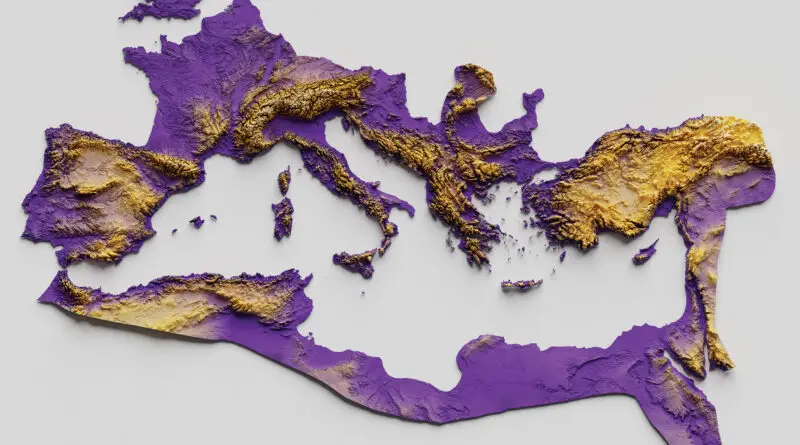
The Roman Empire at its Territorial Height
At its zenith under Emperor Trajan, the Roman Empire spanned 5 million square kilometers, from Britain to the Euphrates. Discover how natural barriers shaped its borders and strategy, and compare its vast expanse to modern nations through our interactive maps.
Read more: The Roman Empire at its Territorial HeightNeolithic agriculture
Areas where Agriculture had been discovered independently of outside influences
Read more: Neolithic agricultureLinguistic composition of Transylvania by municipality (1910)
Red – Hungarian, Purple – Romanian, Green – German
Read more: Linguistic composition of Transylvania by municipality (1910)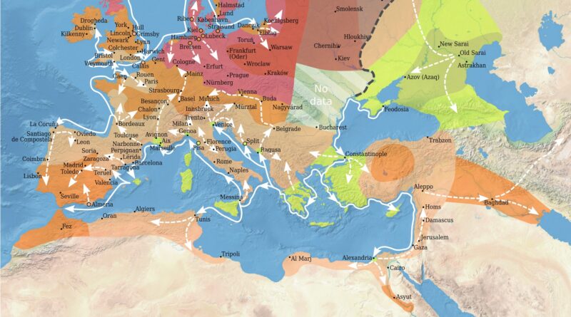
Spread of the Bubonic Plague in Europe
The Black Death reached Europe in 1347 via ships from the Black Sea port of Kaffa. It traveled quickly along principal trade routes, reaching Constantinople, Sicily, and Italy by 1348 and sweeping through France, England, the Holy Roman Empire, and into Scandinavia and Russia by 1351.
The plague followed trade and pilgrimage routes, killing 75 to 200 million humans worldwide. Up to 60% of Europe’s population died, causing vast social, economic, and cultural upheaval.
Read more: Spread of the Bubonic Plague in EuropeEurope (1648)
The peace of Westphalia.
Read more: Europe (1648)The world’s top 10 most populous cities from 100 AD to today
It is difficult to determine the exact population of ancient cities. However, based on historical records and available estimates, here are some cities that were considered significant and populous in different historical epochs, along with their approximate populations.
Read more: The world’s top 10 most populous cities from 100 AD to today