10k+ people draw the former inner-german border
This is what happened. The video was created with leaflet-headless and leaflet-image. Via blog.webkid.io
Read more: 10k+ people draw the former inner-german border
Historical maps showing territorial changes of countries and historical events of the past.
This is what happened. The video was created with leaflet-headless and leaflet-image. Via blog.webkid.io
Read more: 10k+ people draw the former inner-german border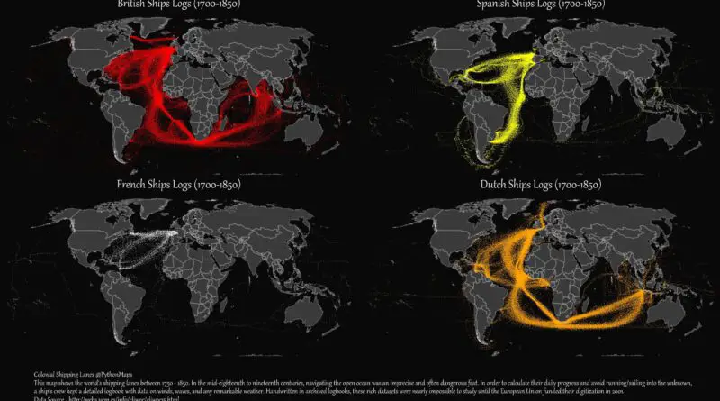
Two centuries ago, the ships that sailed in these waters had a distinct appearance. During the colonial era, explorers and traders sailed from one coast to another in order to expand their empires or to seek personal wealth.
Read more: European Colonial Shipping LanesIt’s no secret that the world’s economic center of gravity has been shifting east ever since the 1950s. And one
Read more: How GDP shares have shifted across the world since 1000 AD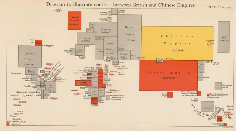
The largest empire was the Qing dynasty by the percentage of the population, which accounted for nearly 400 million of the globals’ ~1 billion people around the late 18th century – an extraordinary 37%. The empire controlled over the entirety of nowadays Mainland China (including Tibet), Hainan, Taiwan, Mongolia, Outer Manchuria, and Outer Northwest China.
Read more: Largest empires by the percentage of the global population