A Breathing Earth
The data comes from NOAA STAR, the center for satellite applications and research, who use the VIIRS (Visible Infrared Imager
Read more: A Breathing Earth

The data comes from NOAA STAR, the center for satellite applications and research, who use the VIIRS (Visible Infrared Imager
Read more: A Breathing EarthIndicators: Cohesion– Security Apparatus– Factionalized Elites– Group Grievance Economic– Economic Decline– Uneven Economic Development– Human Flight and Brain Drain Political–
Read more: Fragile States Index (2017)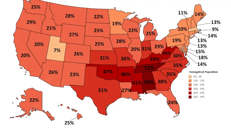
Reddit user: lursh123 Related post: – Mormons in the United States – Southern Baptists in the United States
Read more: Evangelical Population in the United StatesReddit: sendherhome22
Read more: Distance to Biggest Export Partner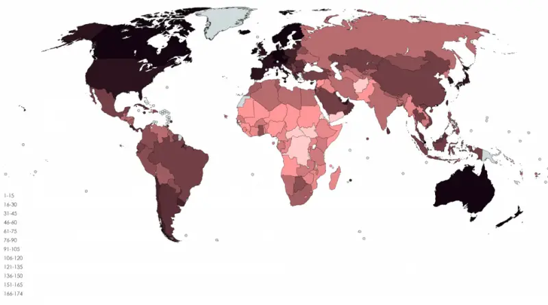
Human Development Index Human Development Reports – Income Inequality – Inequality in Education – Inequality-Adjusted Human Development Index – Inequality-Adjusted
Read more: Countries from best to worst based on 29 index aggregateTravel time to major cities (in hours & days) and shipping lane density. Facts: – Only 10% of the land
Read more: A global map of AccessibilityThe seven days of creation are illustrated in the panels at the top of the map.
Read more: Moxan’s Map with a view of the world as known in 1681Top 10 countries with the largest travel industries (GDP)1. United States ($488 billion)2. China ($224 billion)3. Germany ($130.8 billion)4. Japan
Read more: Travel and Tourism % of Total Economy (2017)
The U.S. has 264,837 square miles of water, accounting for 7 percent of the total area of the country. Percentage
Read more: Percent of area covered by waterWorld population (2000 – 2016) Youtube World population (2016) Cartogram of the World Population (2016) Source: www.vividmaps.com
Read more: World population by country (2000 – 2016)