% of Africans who can read
Reddit user: MorningEcho
Read More
Reddit user: MorningEcho
Read More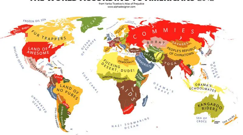
Atlas of the maps below illustrates stereotypes, providing an impression of how particular regions of the world view others.
Read More
Reddit user: trinitronbx
Read More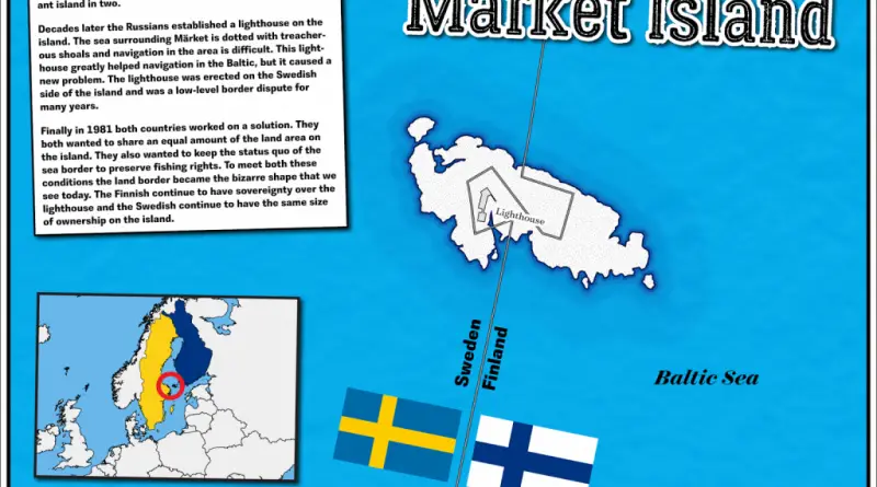
Märket Island is a small, unique island located in the Baltic Sea, between Sweden and Finland. The island is split in half, with its western part belonging to Sweden and its eastern part to Finland. This division is a result of a land swap agreement between Sweden and Russia (which controlled Finland) in the 19th century. Märket Island is particularly famous for its shared lighthouse, where the kitchen and living room are in Sweden, and the bedrooms are in Finland. This arrangement reflects the peaceful coexistence and cooperation between the two countries despite the island’s unusual border.
Read MoreReddit user: trinitronbx
Read More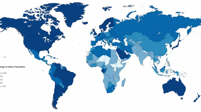
Reddit user: Irmfried The world average percentage of urban population is 54.3%, compared to 46.5% in 2000 and 33.6% in 1960.
Read MoreVia Wikipedia
Read MoreEvery Country’s Biggest Import – 97 of 187 countries – over half – import some kind of fuel more than
Read MoreRelated posts: – Old maps and views of 18th Century London – The Great Fire of London … London maps
Read More