Historical Maps

The Changing Shoreline of New York City

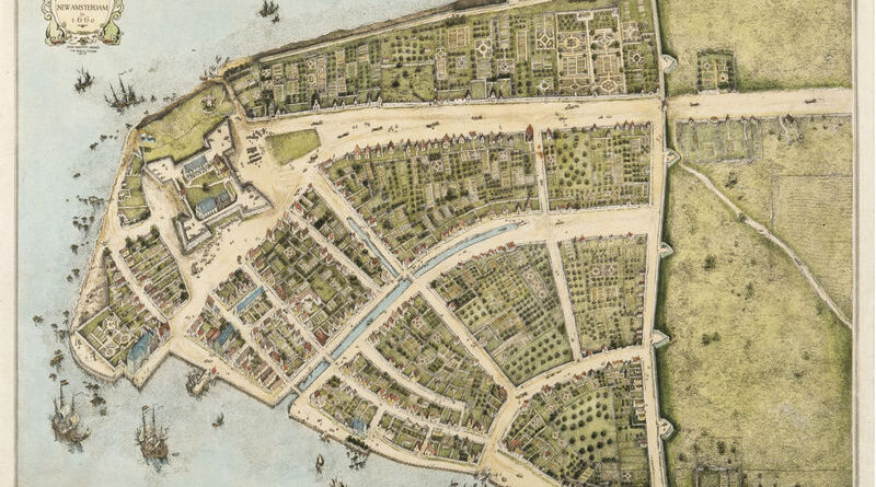
Manhattan below City Hall is 50% larger than in the 1620s. Maps show the Heere Gracht canal (1626-1676), English water lots that added 500 acres by 1776, Castle Clinton built 300 feet offshore in 1808, Egbert Viele’s 1865 map showing landfill extent, Battery Park City’s 92 acres from World Trade Center excavation (1968-1976), and T. Kennard Thomson’s 1911 plan to dam the East River.

Read more: The Changing Shoreline of New York City
Population

How U.S. State Population Centers Shifted Over a Century

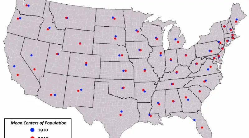
Most U.S. states have seen their population centers shift over the past century. California’s center is now closer to its southern coast and Bay Area than it was in the 1900s. Texas moved southeast as its big cities expanded. Florida’s center went south down the peninsula. Arizona’s shifted toward Phoenix. New Mexico’s moved toward Albuquerque. A handful of states like Wyoming, Vermont, and Rhode Island have barely budged from where they started.

Read more: How U.S. State Population Centers Shifted Over a Century
Ethnic maps

Where the largest shares of people identifying as white still live in Canada and the United States

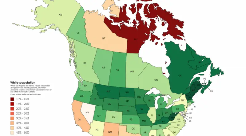
New Brunswick 90.16%, Vermont 89.3%, West Virginia 89.14%. Atlantic Canadian provinces and rural American states have the highest white population shares in North America. Post-1970s immigration concentrated in Toronto, Vancouver, and major U.S. gateway cities, leaving these regions demographically unchanged.

Read more: Where the largest shares of people identifying as white still live in Canada and the United States
Transport

Mapping America’s Car Dependency by County

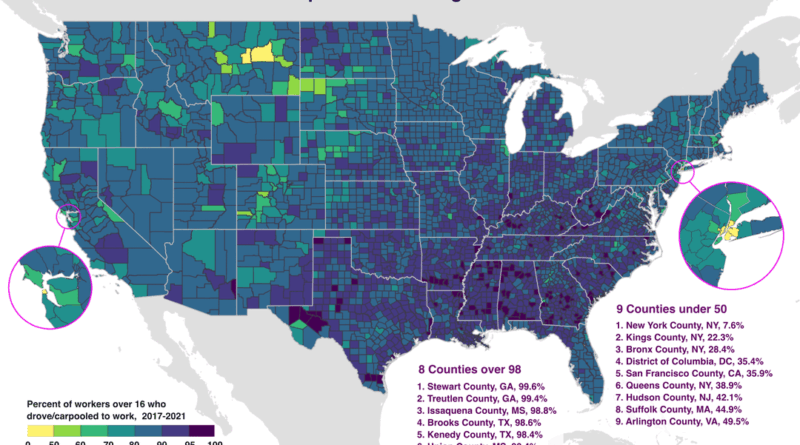
In Stewart County, Georgia, 99.6% of workers drive to their jobs. In Manhattan, just 7.6% do. This map using Census Bureau data from 2017-2021 shows which American counties are most car-dependent and where alternatives exist. Eight counties exceed 98% driving rates, all in rural areas. Nine counties fall below 50%, concentrated in dense urban centers with transit systems.

Read more: Mapping America’s Car Dependency by County