Births Outside Marriage in Europe: Trends, Changes, and the Future
Marriage is no longer the default in many European countries. See where births outside marriage are most common, how trends are shifting, and what the future may hold.
Read More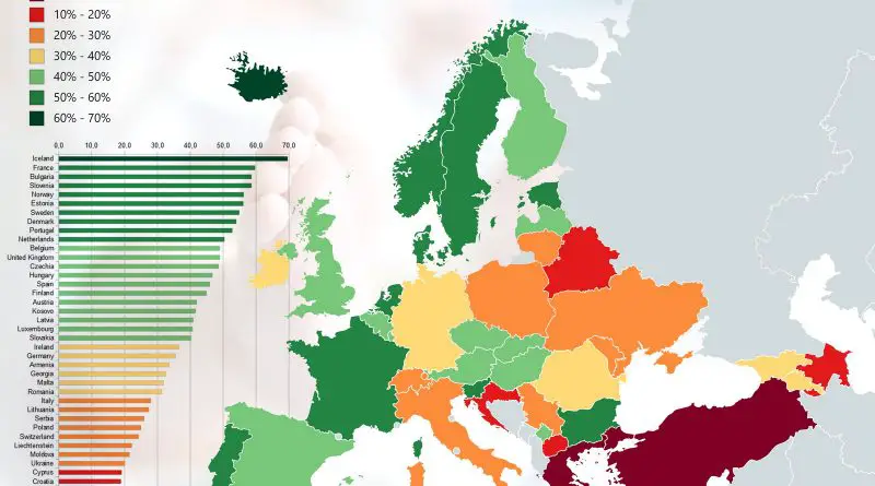
Marriage is no longer the default in many European countries. See where births outside marriage are most common, how trends are shifting, and what the future may hold.
Read More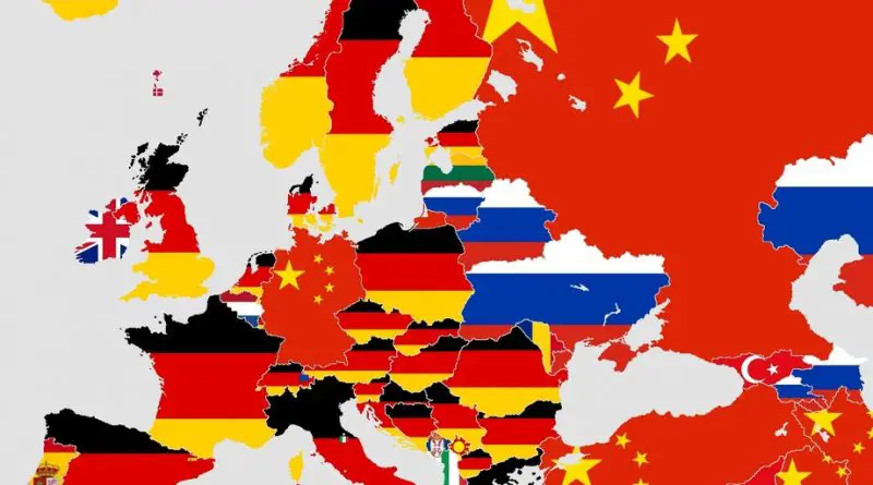
Discover how Europe’s trade relationships have transformed from 2018 to 2023, influenced by geopolitical events and economic shifts.
Read More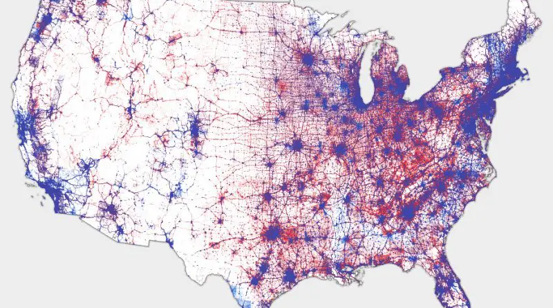
Most election maps mislead by shading entire counties red or blue, but what if we mapped every single vote exactly where people live? This dasymetric dot density map does just that—placing 130+ million dots based on urban, suburban, and rural population densities. The result? A clearer, more accurate picture of the 2016 election. See the real voting patterns emerge! 🔴🔵 Explore the map now.
Read More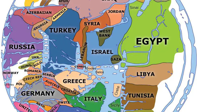
The Hereford Mappa Mundi is more than just a medieval map—it’s a glimpse into how people once saw the world, blending history, geography, and myth in a single masterpiece.
Read More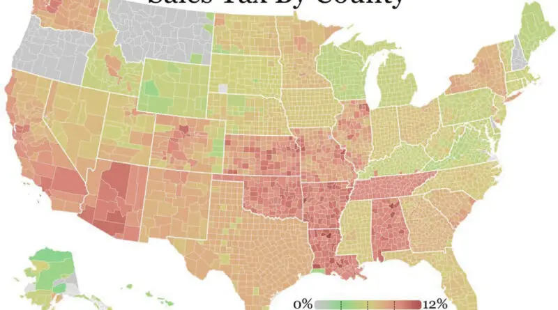
Discover how U.S. sales tax rates have changed from 2022 to 2025, with insights into state and local adjustments and their broader impacts.
Read More
Every NYC neighborhood has its local characters – including superheroes. Find out which defenders might be watching over your corner of the city.
Read More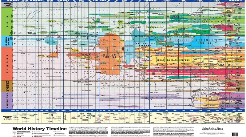
Is it possible to show everything that has happened in world history on one map poster? The diagrams below are excellent attempts to depict countries and their time of existence and the lifetime of influential historical figures on one map.
Read More
The American housing market has changed significantly, altering the traditional rent-versus-buy equation. While homeownership was once considered the best financial move, rising costs have flipped the script in many places. Explore what’s behind this shift and see how your city compares.
Read More
In 1900, reaching 65 was a rare achievement. Today, most of us will celebrate our 65th birthday and beyond. But this remarkable change hasn’t happened equally for everyone – here’s what our maps reveal about who lives longer, where, and why.
Read More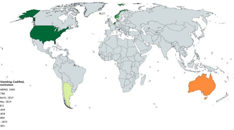
Dive into the fascinating history of the world’s oldest constitutions still in effect. From San Marino’s 1600 statutes to Australia’s 1901 constitution, explore how these foundational documents have guided nations through centuries.
Read More