Exploring Europe’s Urban Landscape
Dive into Europe’s evolving urban landscape with interactive visualizations and up-to-date population insights.
Read More
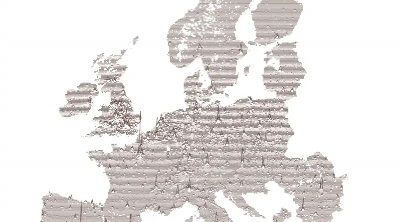
Dive into Europe’s evolving urban landscape with interactive visualizations and up-to-date population insights.
Read More
What happens when we split the world not by borders, but by people and wealth? Two maps show the world divided into equal population and GDP regions, revealing deep imbalances in global distribution. Let’s take a closer look!
Read More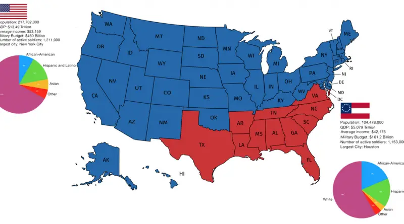
ow do the states of the former Confederacy compare to the rest of the United States today? The map breaks it down by population, GDP, income, and demographics. Let’s dig into the data and explore what it means.
Read More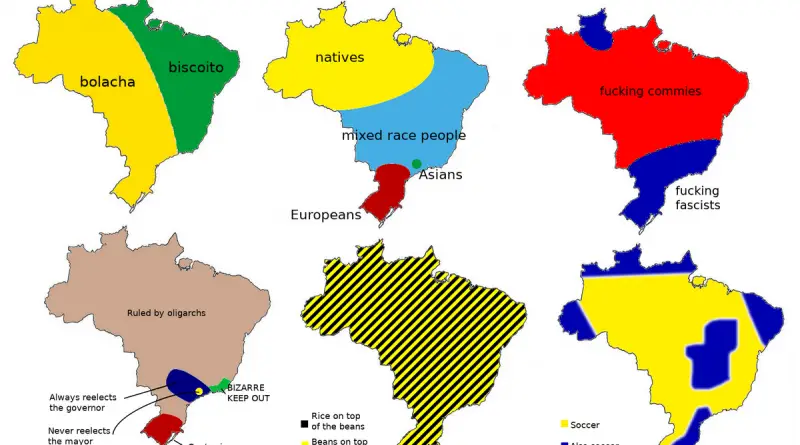
From “drowning in your own sweat” summers to debates about whether rice goes on top of beans (or vice versa), these user-created maps offer an amusing, if irreverent, window into Brazil’s remarkable regional diversity. While they shouldn’t be taken too seriously, they highlight how this massive nation contains multitudes.
Read More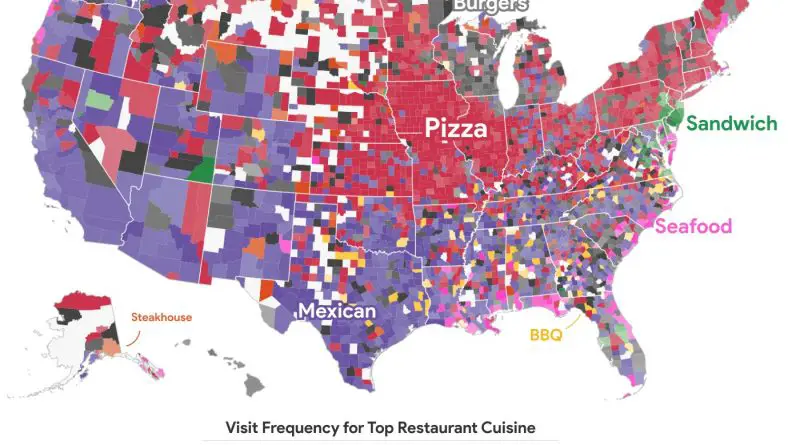
What’s the most popular cuisine in your state? A detailed look at food trends across the U.S. shows a strong regional divide between Mexican, Chinese, and other favorite dishes. See how America’s food preferences break down and which cuisines are gaining popularity.
Read More
How do forests and human settlements coexist? This article explores tree cover distribution, deforestation trends, and the patterns revealed by global maps.
Read More
Royal Mail Ship (RMS) Titanic was a British passenger liner that sank in the North Atlantic Ocean after it collided with an iceberg during its maiden voyage from Southampton to New York City. The ship had around 2,224 passengers and crew members onboard, but unfortunately, over 1,500 of them lost their lives, making it one of the most lethal maritime disasters during peacetime in recent history.
Read More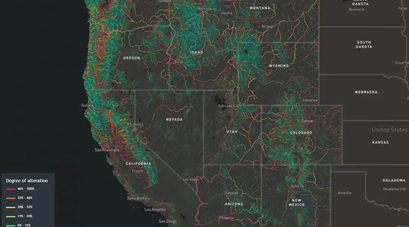
Rivers across the western U.S. are vanishing—140,000 miles of them have been rerouted, dammed, or dried up. This post looks at what’s behind the loss, which states are hardest hit, and how maps can help us understand what’s at stake.
Read More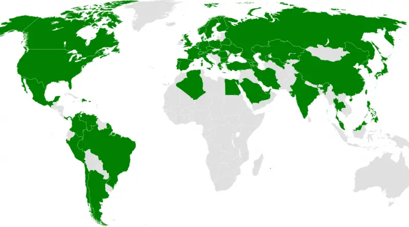
From London’s smoky tunnels to Shanghai’s high-speed sprawl—explore the countries with subway systems and how they’ve evolved into global transport powerhouses. Includes a comparison table of the world’s largest metro systems.
Read More
Finland and France top the list of European nations by government spending as a share of GDP. But what does that actually mean for the people who live there? This post explores what high and low spending really tells us about economic policy, public services, and everyday life.
Read More