
Skip to content
VividMaps

  • Atlases
  • Map Posters
  • Scratch Maps
  • Globes
  • Videos
FoodNatural disastersOld maps
August 27, 2017 Alex

1832 map of Mount Vesuvius showing routes of lava flows across 200 years of major eruptions

Read more: 1832 map of Mount Vesuvius showing routes of lava flows across 200 years of major eruptions →
EducationWorld
August 27, 2017 Alex

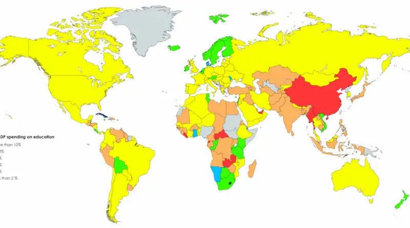
% of GDP spending on education

Reddit user: s251572

Read more: % of GDP spending on education →
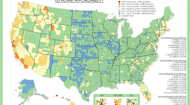
Home Affordability in the United States mapped
Economic mapsReal estate
August 27, 2017 Alex

US Home Affordability Mapped

Housing affordability has become one of those topics everyone talks about but struggles to quantify. We hear about median prices rising, interest rates fluctuating, and markets “cooling” or “heating up.” But what does affordability actually look like when you map it county by county?

Read more: US Home Affordability Mapped →
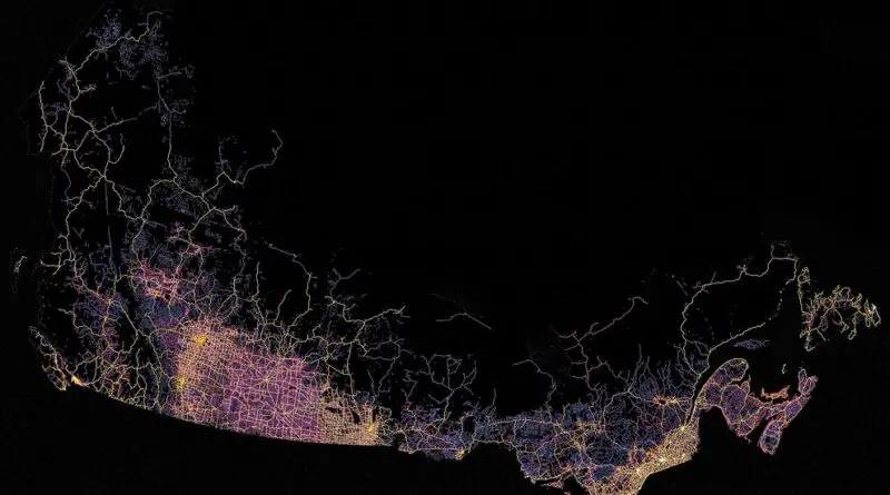
Canadian Roads
Transport
August 26, 2017 Alex

Roads and highways in Canada Mapped

Canada is the second-largest country in the world. Therefore, it is not surprising that the total length of all roads in Canada is 1,042,300 kilometers (647,655 miles), of which 415,600 kilometers (258242 miles) are paved.

Read more: Roads and highways in Canada Mapped →
Economic mapsGermanyInteractive mapsReal estate
August 26, 2017 Alex

Birthplaces of German Members of Government since 1949

– Despite being a party with usually very low voter share, the FDP (liberals) has participated in almost every German

Read more: Birthplaces of German Members of Government since 1949 →
Natural disasters
August 26, 2017 Alex

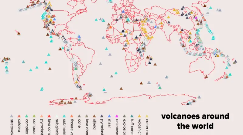
Volcanoes around the world

Volcanoes around the world classified by type and height.  

Read more: Volcanoes around the world →
Economic mapsMapping StereotypesNatureWorld
August 26, 2017 Alex

Countries richer & poorer than the world average (GDP per capita)

Reddit user: sandyisback

Read more: Countries richer & poorer than the world average (GDP per capita) →
Economic maps
August 25, 2017 Alex

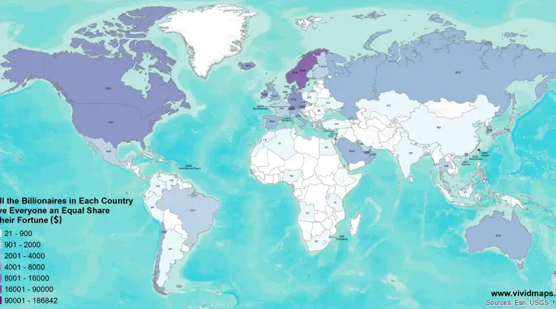
If All the Billionaires in Each Country Gave Everyone an Equal Share of their Fortune

If All the Billionaires in Each Country Gave Everyone an Equal Share of their Fortune ($) If the Richest Billionaire

Read more: If All the Billionaires in Each Country Gave Everyone an Equal Share of their Fortune →
BuildingSpace
August 25, 2017 Alex

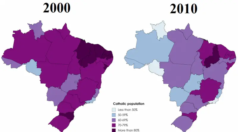
Decrease of Catholicism in Brazil according to the censuses of 2000 & 2010

Brazil has the largest Catholic population in the world, but in the last decades, this predominance of Catholicism has been

Read more: Decrease of Catholicism in Brazil according to the censuses of 2000 & 2010 →
ForecastsGoogleInternetNature
August 25, 2017 Alex

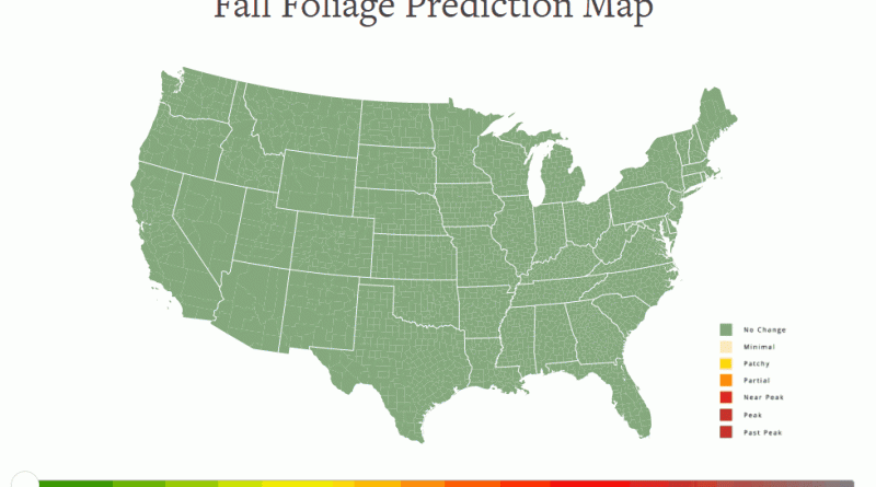
The fall foliage prediction map (2017)

Youtube version This map is meant to help travelers better time their trips to have the best opportunity of catching

Read more: The fall foliage prediction map (2017) →
Submarine Cable map
InternetMapping StereotypesWorld
August 25, 2017 Alex

Submarine Cable map

The first internet connections appeared in 1969, while the international connection across the Atlantic Ocean appeared in 1973. Today, there are over 420 submarine cables in service, extending over 1.1 million kilometers (700 thousand miles) around the globe.

Read more: Submarine Cable map →
Population
August 25, 2017 Alex

Half the Population of Each U.S. State

The spatial distribution of the U.S. population is a result of a complex interplay of historical, geographical, economic, and social factors, creating a diverse and dynamic landscape that continues to evolve over time.

Read more: Half the Population of Each U.S. State →
Mapping HealthScience
August 24, 2017 Alex

Plastic Surgeon Density by U.S. State

The map above shows the number of plastic surgeons per one million people. Those U.S. states in shades of red

Read more: Plastic Surgeon Density by U.S. State →
Page 124 of 521« First«...120121122123124125126127128...»Last »

Trending now

  • Settlements and native tribes in North America in 1650 Mapped
    The Americas in 1650, Just Before the Dutch and Swedish Colonies EndedOct 22, 2026
  • Map of New Netherland and New Sweden
    The Dutch and Swedish Colonies That Once Held the Mid-Atlantic CoastOct 7, 2023
  • Map of greek colonies
    Ancient Greek Colonies on the Map, From Marseille to CrimeaOct 21, 2026

Related Products

  • Push pin maps
  • Globe drinks cabinets
  • Maps of the United States
  • Board games
  • Monopoly
  • Map-based strategy board games
  • History Board Games
  • Coloring Books
  • Handheld GPS
  • GPS Watches
  • GPS Trackers

Vivid Maps Tools

  • Convert Latitude/Longitude
  • Elevation Finder
  • Distance Calculator
  • Kilometers to Miles Distance & Length Converter
  • Weight Converter
  • Volume Converter
  • Daylight Comparison
  • Time Zone Converter
  • Antipodes Map
  • Find cities with a similar climate
  • Find cities with a similar climate (2050)
  • How hot cities could be in 2050
  • The U.S. Population Lines

Stay connected

Get the latest maps, insights and updates delivered to your inbox.

Unsubscribe anytime.

VividMaps

Maps that explain the world.

Beautiful, data-rich maps to help you understand our world — its people, places and connections.

Explore

World map World atlas Map posters Globes

Company

About Privacy Contact

Stay connected

Follow us for the latest maps, insights and updates.

Independent WebsiteVirusScanner trust report for vividmaps.com
© 2026 Vivid Maps. All rights reserved.
A more connected world