The fall foliage prediction map (2017)
Youtube version This map is meant to help travelers better time their trips to have the best opportunity of catching
Read More
Youtube version This map is meant to help travelers better time their trips to have the best opportunity of catching
Read More
The first internet connections appeared in 1969, while the international connection across the Atlantic Ocean appeared in 1973. Today, there are over 420 submarine cables in service, extending over 1.1 million kilometers (700 thousand miles) around the globe.
Read More
The spatial distribution of the U.S. population is a result of a complex interplay of historical, geographical, economic, and social factors, creating a diverse and dynamic landscape that continues to evolve over time.
Read MoreThe map above shows the number of plastic surgeons per one million people. Those U.S. states in shades of red
Read More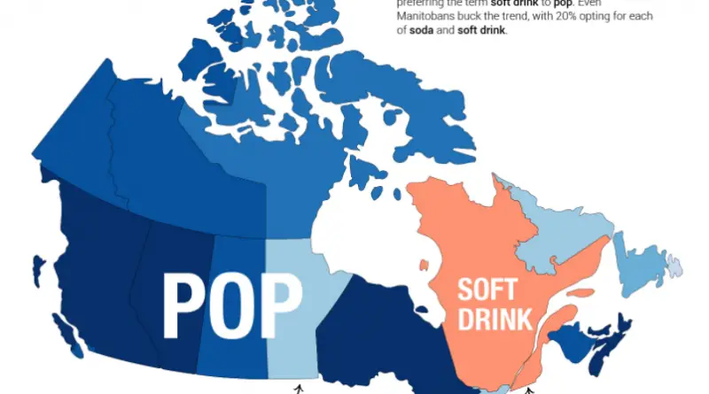
Pop vs Soda vs Soft drink Pop is that prototypical Canadianism that distinguishes us from our neighbours to the south,
Read MoreReddit user: Tjukanov
Read MoreReddit user: eivarXlithuania Related post: – Metropolitan Areas of the U.S.
Read MoreThis map plots the first year in which the U.S. had the same GDP per capita, adjusted for prices, as
Read MoreThe pessimistic scenario developed by Co$ting Nature removes the pixels corresponding to forest cover over time from the average annual
Read More