Understanding Food Insecurity in the United States
Discover how USDA maps and data reveal the scope and regional disparities of food insecurity in the U.S., helping us understand and address this growing challenge.
Read More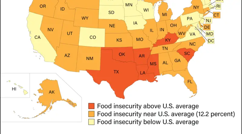
Discover how USDA maps and data reveal the scope and regional disparities of food insecurity in the U.S., helping us understand and address this growing challenge.
Read More
Religious adherence as a percentage of all residents (2010) Religious adherence as a percentage of all residents (1890 – 2010)
Read More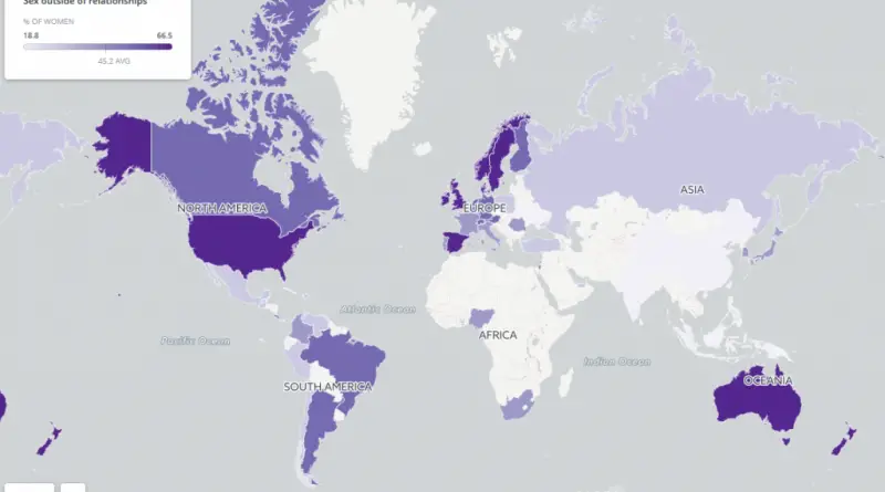
Where women are having sex outside of relationships. https://goo.gl/J6tgaQ Facts: – China is bottom of the list of 49 countries
Read More
In Canada, there are two official languages: English and French. English is the most widely spoken language in the country, while French is primarily spoken in the province of Quebec and also has a significant presence in other parts of the country. But 93% of French speakers in Canada live in the eastern part of Canada.
Read MoreReddit user: trinitronbx
Read Moremental_floss, source: ranker.com – Hamburger is most popular in 16 states: Alabama, Delaware, Idaho, Indiana, Kentucky, Maine, Michigan, Mississippi, Nebraska,
Read MoreThe map below combines data from all images of France acquired by the Operational Land Imager on the Landsat 8
Read More
Source: washingtonpost.com Many U.S. West Coast cities are sandwiched by the Pacific Ocean and mountains to the east, squeezing traffic
Read MoreState capitals are the primary administrative centers of their respective states or territories. They serve as the headquarters for the government, housing the executive, legislative, and often judicial branches.
Read MoreIn the past, there already exists an American Mediterranean Sea. According to Wikipedia, The American Mediterranean Sea is the combined
Read More