Isoscope: Exploring mobility
Isoscope is an interactive tool that creates aesthetic visuals about locations that are reachable by a car at a chosen
Read more: Isoscope: Exploring mobility
Isoscope is an interactive tool that creates aesthetic visuals about locations that are reachable by a car at a chosen
Read more: Isoscope: Exploring mobility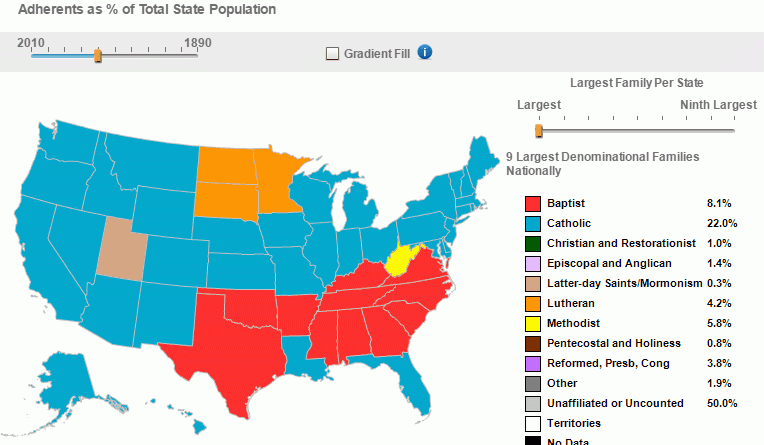
Largest denominational family per state (1971 – 2010) Second largest denominational family per state (1971 – 2010) Third largest denominational
Read more: Largest denominations families in the United States (1971 – 2010)“Film map: The history of popular film set to the art of Cartography” … LA maps
Read more: Map of Los Angeles with the streets renamed after famous moviesRelated post: – United States Old Maps
Read more: Population density of the 13 colonies (1775)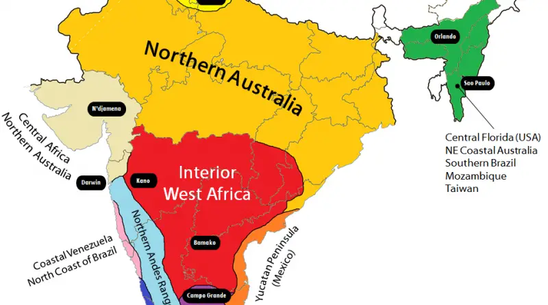
Each region of India climatically equivalent to the regions of the World whose names are overprinted, in the above map.
Read more: Climate analogues of India
Each pin shows how much you’d need to earn per hour to rent in that postcode (based on a single
Read more: The hourly salary needed to rent in BritainRelated posts: – Mapping Displacement and Gentrification in the San Francisco Bay Area – America’s great housing divide: Are you
Read more: San Francisco zoning map (January 2017)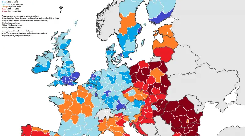
The Regional Innovation Index is a sub-pillar of the Regional Competitiveness Index, which measures the general competitiveness of EU regions.
Read more: EU Regional innovation index (2016)This 3D web map allows users to learn more about the Morningside Heights Historic District, which the New York City
Read more: Morningside Heights Historic District Explorer