Global Peace Index 2017
Related posts: – Global Peace Index 2016 – Global Peace Index 2015
Read MoreRelated posts: – Global Peace Index 2016 – Global Peace Index 2015
Read More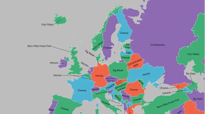
Related posts: – What Does Each Country Export the Most to the United States? – What Does Each Asian Country
Read MoreThis map of comparing climates of the cities has been created using Global environmental stratification. The Global environmental stratification (GEnS) is based on statistical clustering of bioclimate data (WorldClim). GEnS consists of 125 strata, which have been aggregated into 18 global environmental zones (labeled A to R) based on the dendrogram
Read More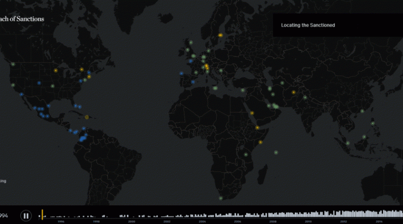
The U.S. sanctions list encompasses businesses and people based all over the world. Even programs associated with a specific country
Read MorePercentage of people 15 years or older who smoke according to the World Health Organization (2015). Reddit user: fraillimbnursery
Read MoreHousehold debt levels 2000–2016. Debt per adult by country (2000 – 2016) Youtube Debt per adult by country, 2016
Read MoreSince from 1990 levels, the U.S. marriage rate has fallen from 9.8 marriages per 1,000 down to 5.1 marriages per 1,000 population in 2020. That marriage rate is the lowest level since the U.S. administration began keeping marriage registers for the nation in 1867.
Read More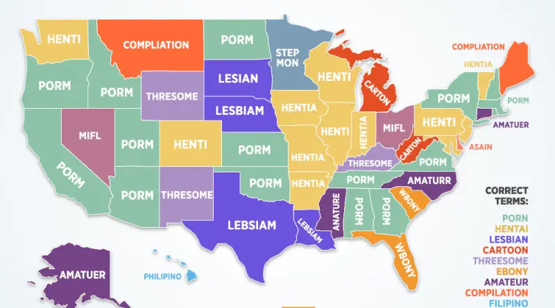
Top searched “how to spell” by U.S. state. GoogleTrends The most commonly misspelled porn search in every U.S. state.
Read MoreDive into the fascinating world of legal professionals with our comprehensive analysis of lawyers per capita in the United States and Canada. Uncover which states and provinces have the highest and lowest concentrations of lawyers, explore historical trends, and understand the factors driving the distribution of legal talent. From Washington D.C.’s unmatched density to the educational paths required to become a lawyer, this article provides a detailed look at the legal landscape across North America.
Read More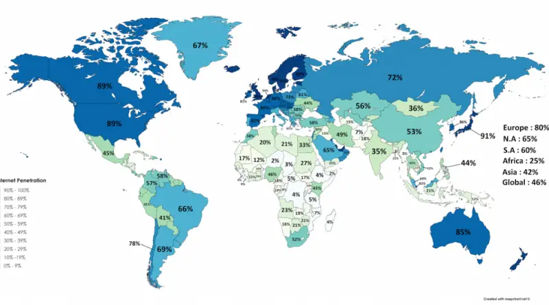
Map of the entire Internet in May 1973 All the devices in the world connected to the Internet A map
Read More