Countries with a smaller economy than Luxembourg
Reddit user: https://www.reddit.com/user/Chief_of_Achnacarry Related post: – How many Luxembourg’s can you fit?
Read MoreReddit user: https://www.reddit.com/user/Chief_of_Achnacarry Related post: – How many Luxembourg’s can you fit?
Read MoreThe London Atmospheric Emissions in 3D. Greater London Annual Mean NO2 modeled concentrations for 2020 on a 20m grid. Related
Read MoreGive road-weary eyes a break with this spiral-bound Large Scale edition featuring all the accuracy you’ve come to expect from
Read More
The U.S. Office of Management and Budget determines a Metropolitan Area as one or more neighboring counties, or county-equivalents, that have at least one city no less 50 thousand population, and nearby territory that has a high level of economic and social integration with the core city as estimated by the commuting link. In the U.S. is 392 such metropolitan areas.
Read MoreThe average annual per capita disposal income by household in China in 2014 was about 20,000 yuan or approximately $3,000,
Read MoreWhat was your home county leading the UK in? Did the answer surprise you? This map can act as you
Read More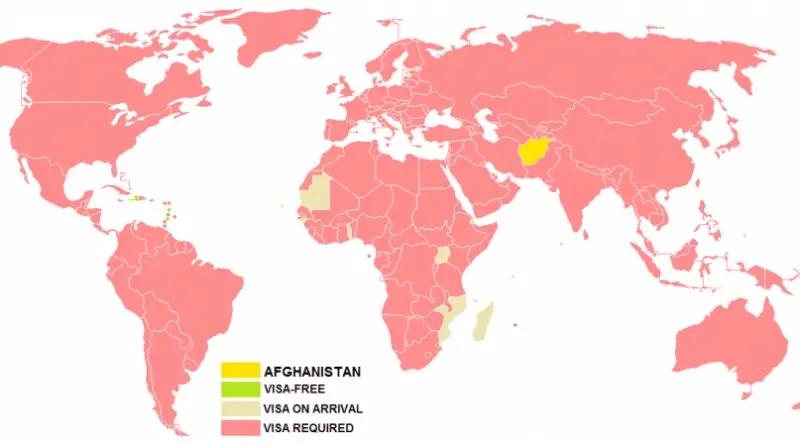
Afghanistan has the least powerful passport in the world.
Read More
The new map of Paris metro system, regional trains, & trams. Via metromap.fr Paris metro lines locations from the aerial
Read More