The Free Wi-Fi Map
500,000+ open, public WiFi hotspots. Source: www.meshable.io/map Related posts: – World Wi-Fi Map
Read more: The Free Wi-Fi Map
500,000+ open, public WiFi hotspots. Source: www.meshable.io/map Related posts: – World Wi-Fi Map
Read more: The Free Wi-Fi MapRelated posts: – Landscapes (more or less typical) by country
Read more: Iconic architecture on Spain’s mapThis winter has been the wettest on record for Wales, Scotland and Northern Ireland and the second-wettest for the UK
Read more: Winter 2016: rainfall amount % of 1981-2010 average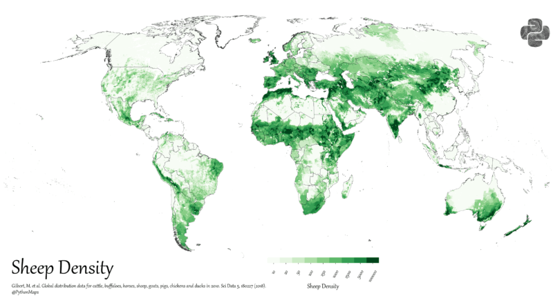
Explore how sheep are distributed around the world. We’ll look at global population trends, explain the numbers, and share a detailed sheep density world map.
Read more: Where in the World Are the Most Sheep?Livestock farming is an important sector of the United States agriculture industry, and the amount of livestock per square mile varies across the country depending on various factors, such as climate, soil quality, and water resources.
Read more: Livestock per sq mile in the USRisk Map is a free to use security and risk mapping system; providing a new and unique way of viewing
Read more: Risk MapRadioooo – new fun global music map that allows you to listen to music from anywhere in the World and
Read more: World Radio MapThe atmosphere contains an enormous amount of moisture that circulates around the globe, shown here in this imagery. However, not
Read more: Atmospheric moisturewww.metricmaps.org/2016/03/03/electricity-to-heat-home/
Read more: Electricity to Heat Home
An intelligence quotient (IQ) is a total score derived from one of several standardized tests designed to assess human intelligence.
Read more: The Intelligence of the Indigenous PeoplesExplore the adopted hometowns of 25,000 Syrian refugees who’ve settled in more than 250 communities across Canada. This map visualizes
Read more: Where 25,000 Syrians have settled in CanadaThis study sets out to answer the question: how have neighborhoods changed since the Civil Rights Movement outlawed discriminatory housing?
Read more: Neighborhood Racial and Ethnic Change Trajectories (1970 – 2010)