
Map of Italian wines
Map of Italian Wine Regions
Read more: Map of Italian wines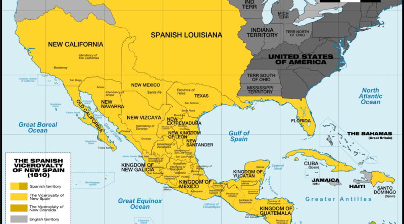
New Spain at Its Height in 1810
Hard to picture, but in 1810 New Spain connected places like California, Cuba, and the Philippines under Mexico City’s control. The map here shows that giant layout across continents, just before a priest sparked revolts that led to all the countries we have today.
Read more: New Spain at Its Height in 1810The State of rural America (2015)
Via modernfarmer.com
Read more: The State of rural America (2015)US born population living in State of birth
The map below shows are more residents born in-state, out of state, or foreign-born?
Read more: US born population living in State of birth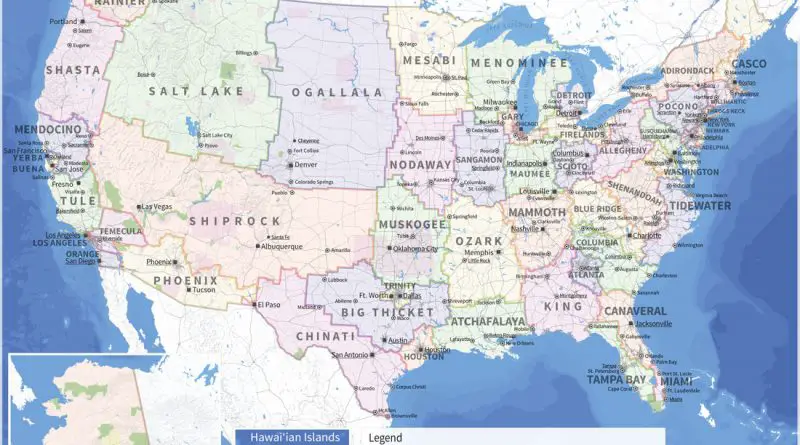
The U.S. redrawn as fifty States with equal population
California is the state with the highest resident population in the U.S., with approximately 39.4 million people. Wyoming has the lowest population, with roughly just 580 thousand residents (2020).
Read more: The U.S. redrawn as fifty States with equal populationFrench cheese map
Blue cheeses of France (production areas) Blue Cheese close connects with the Massif Central (uplands in South-Central France). The Massif
Read more: French cheese map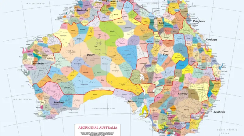
A map of the indigenous languages of Australia
During the late 18th century of colonisation, Australia had over 700 Indigenous languages and dialects spoken. Presently, only around 150 of these languages are in use, but only 15-18 are being acquired as first languages by children.
Read more: A map of the indigenous languages of Australia