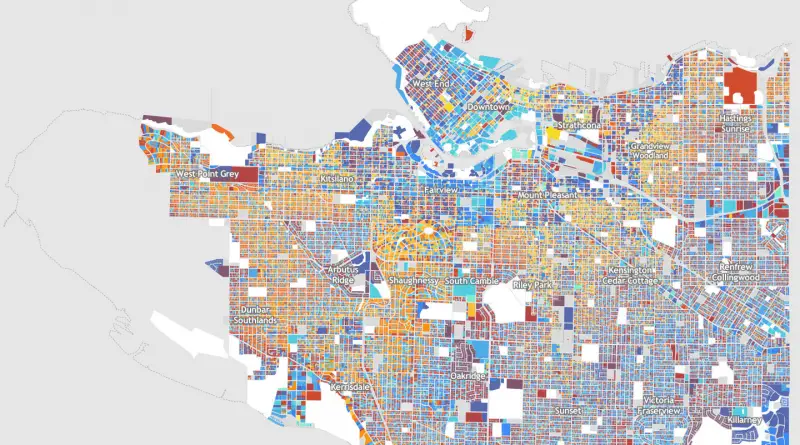
Building Age Maps
London New York http://pureinformation.net/building-age-nyc/#12/40.7512/-73.9366 Amsterdam Vancouver Barcelona Ljubljana Reykjavík Moscow
Read MoreTravel and tourism competitiveness index
via chartsbin.com
Read MoreThe Spanish election map
Red – Spanish Socialist Workers’ Party (PSOE) Blue – Conservative People’s Party (PP) PP (People’s Party, conservatives, right wing) –
Read MoreShrinking the polio map
Via gatesnotes.com
Read MoreRelative economic impacts of water insecurity
Three economic risks have been standardized to the same total economic impact globally: (1) Water scarcity to agriculture; (2) Flood
Read MoreThe global mobile games landscape
newzoo.com
Read MoreWhere do people fail to attain a high school qualification?
Via statista.com
Read MoreWhat the World thinks of Indian States, according to Google
Via huffingtonpost.in
Read More