The Dog Poop Capitals, Mapped
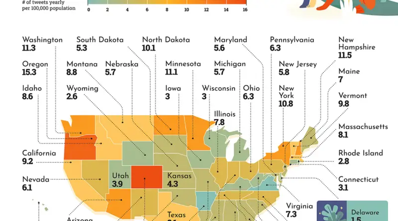
Overall, the U.S. dominates, taking up 12 places within the top 20 results – however, York, Norwich and Manchester represent the UK, taking the top three spots with yuck-y numbers of dog-poop complaints. Pittsburgh, Seattle and Atlanta in the US follow closely behind.
Read More