U.S. Counties away from nearest NFL Stadium
Picture: Reddit CopperWalrus
Read MoreMaps of the US
Picture: Reddit CopperWalrus
Read MoreWhat if we drew the map of the United States based on how people actually live? Dr. Alasdair Rae and his co-author Dr. Garrett Nelson have developed an empirical approach to identify megaregions using a dataset of more than 4 million ‘commuter flows’ involving the travel to work patterns of 130 million Americans.
Read MoreReddit user: Speech500
Read More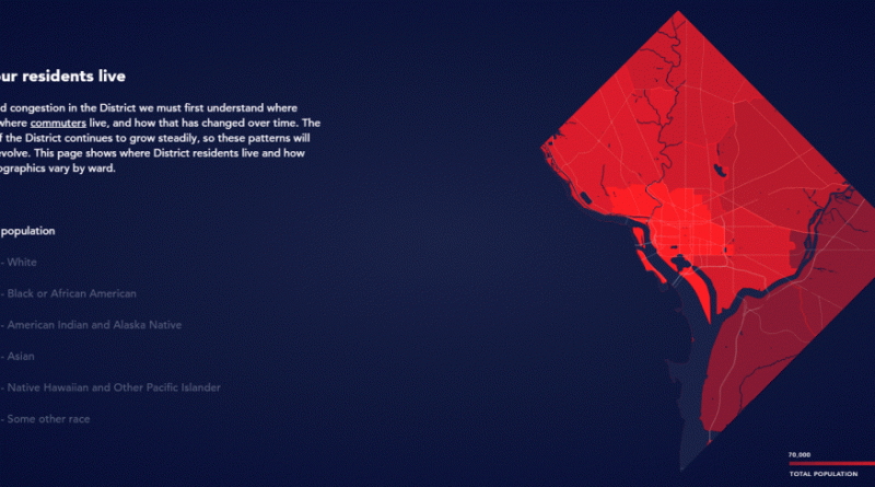
District Mobility is a tool to visualize multimodal transportation system performance within the District of Columbia as a part of
Read MoreVia washingtonpost.com
Read MoreUS states are arranged in the circle according to the number of patents. States with a large number of patents
Read More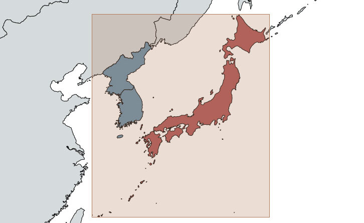
Japan remains one of the most enigmatic countries for Western travelers. Its centuries of isolation created something genuinely unique, and people who visit often find themselves returning to discover more. But here’s something that surprises nearly everyone: Japan is much bigger than it looks on a map.
Read MoreEach European country covers an area of the United States with the same (gross domestic product). The largest/most important cities
Read MoreRelated post: – United States Old Maps
Read MoreIn the study, the researchers identified “genetic communities” throughout North America using data from more than 774,516 people born or
Read More