The Oldest Business in Every Country in the world
There are 5,586 companies in the world whose age exceeds two hundred years. 56% of all the oldest companies in the world are based in Japan.
Read More
Map of all of the surface of Earth. Maps of continents, countries, regions, and cities.

There are 5,586 companies in the world whose age exceeds two hundred years. 56% of all the oldest companies in the world are based in Japan.
Read More
Now that 2019 is almost done, we think it would be interesting to look backward at our most favored maps of the year.
Read More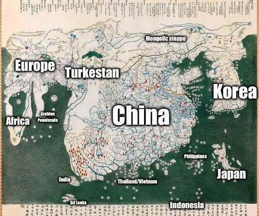
In 1402, Korean scholars completed a world map showing the full Old World – Africa with ~35 place names, Europe with over 100, China at the center, and Japan to the east. It depicted Africa’s southern tip nearly a century before Vasco da Gama’s voyage.
Read More
he estimated average GDP per capita of all of the world’s countries is Int$18,381 (2019). Luxembourgers have the highest per capita gross domestic product in the world. According to the International Monetary Fund, in 2021, the GDP per capita in Luxembourg amounted to about US$122,740.
Read More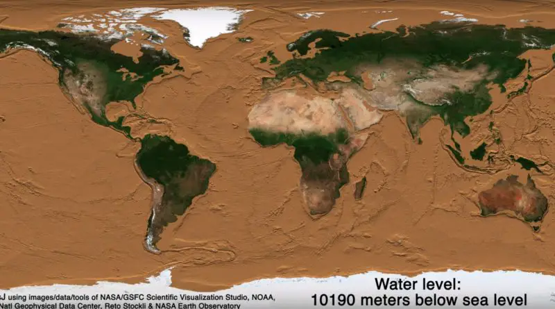
We know that the world ocean is bottomless and that the deepest trench in the world has almost 11 kilometers. We also know that the world ocean covers about 70 percent of our planet, making more than 2/3 of Earth’s surface unseen to us. But assume we obtained a way to drain oceans of our world, what would Earth’s exterior look like, exactly?
Read MoreA mind-bending look at Earth’s future: how tectonic movements will dramatically reshape our world map, creating landscapes beyond imagination.
Read More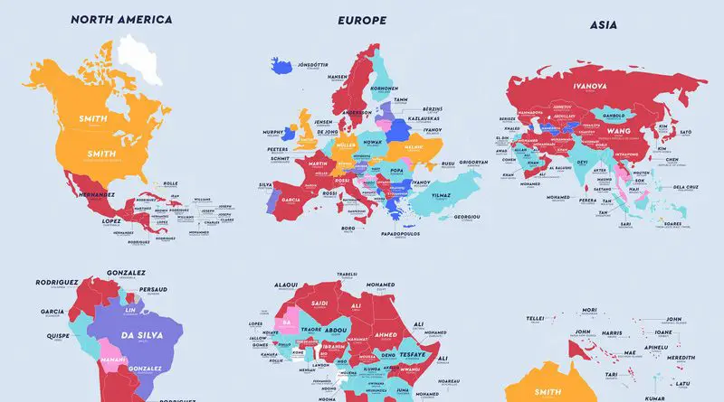
The last name is the part of a personal name that indicates a person’s family. All family members usually have identical surnames, or there may be differences based on the cultural rules. By origin, all last names can be classified into 4 broad groups: given name (patronymics), occupational name, local name (toponymic), and personal characteristic or nickname.
Read More
The maps are based on distance from cities, roads, railways, and airports. The green areas represent places where travel to the city, road and other transportation facilities can be measured in hundreds of kilometers.
Read More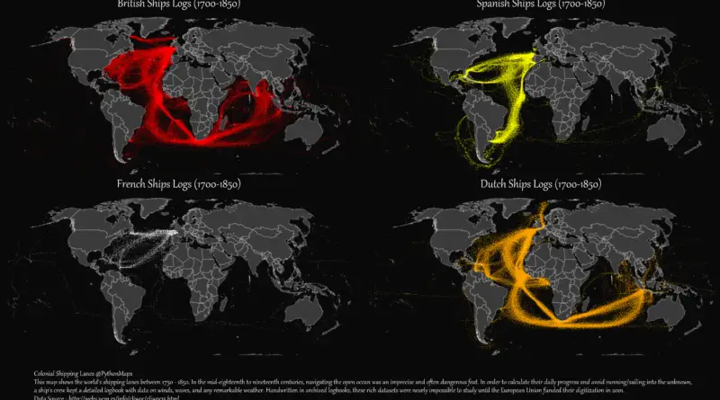
British colonial shipping lanes covered vast expanses, connecting the British Isles to North America, the Caribbean, South Asia, and the Pacific. Spanish lanes were primarily transatlantic, centered on the Atlantic Ocean and Caribbean. French routes spanned the Atlantic, Indian, and Pacific Oceans, reaching North America, the Caribbean, Southeast Asia, and the South Pacific. Dutch shipping lanes had a global reach, including the Indian and Pacific Oceans, with a strong presence in Southeast Asia and the East Indies.
Read More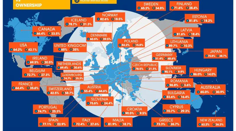
22 of 36 developed countries (61%) saw a decline in home ownership over the last 10 years. Today UK residents need at least two months’ average salary to purchase just one square meter of home.
Read More