
Old maps
Map of the Americas (1550)
1550 Map of North and South America labeled in German. Geographic features otherwise in Latin.
Read more: Map of the Americas (1550)U.S. Vegetation Map (1970)
Detailed vegetation map in The National Atlas of the United States of America (USGS, 1970, Gerlach). This 1:7,500,000-scale map, in
Read more: U.S. Vegetation Map (1970)Indians of South America
Long before European explorers arrived, South America was home to thriving Indigenous cultures.
Read more: Indians of South America
A British map of New York City (1776)
“A Plan of the City and Environs of New York in North America.” Related posts: – Interactive map of New
Read more: A British map of New York City (1776)The distribution of woodland within the territory of the U.S. (1873)
Related post: – United States Old Maps
Read more: The distribution of woodland within the territory of the U.S. (1873)The World according to Ronald Reagan (1987)
Related posts: – The World according to Donald Trump (2016) – A map of the World according to Donald Trump
Read more: The World according to Ronald Reagan (1987)
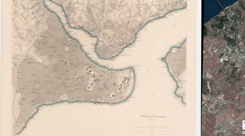
Istanbul urban database
Istanbul urban database is an ongoing digital humanities project, digitizing and visualizing the historic urban archives of Istanbul. Istanbul Urban
Read more: Istanbul urban databaseCar sales in the European Union (2016)
In 2016, new passenger car registrations showed a consistent increase (+6.8%), totalling 14,641,356 units and marking the third consecutive year
Read more: Car sales in the European Union (2016)