Skip to content
VividMaps

  • Atlases
  • Map Posters
  • Scratch Maps
  • Globes
  • Videos
Economic mapsMapping StereotypesSliderVivid maps
July 5, 2017 Alex

Mean and median wealth per adult in Europe

Mean wealth per adult in Europe Median wealth per adult in Europe Related posts: – Wealth estimates in Europe – Household wealth

Read more: Mean and median wealth per adult in Europe →

Historical MapsPolitical maps
July 5, 2017 Alex

A map of Canada’s first ever election (1867)

A little late for Canada 150, but here is a map of Canada’s first ever election – held between August

Read more: A map of Canada’s first ever election (1867) →
ClimateSlider
July 5, 2017 Alex

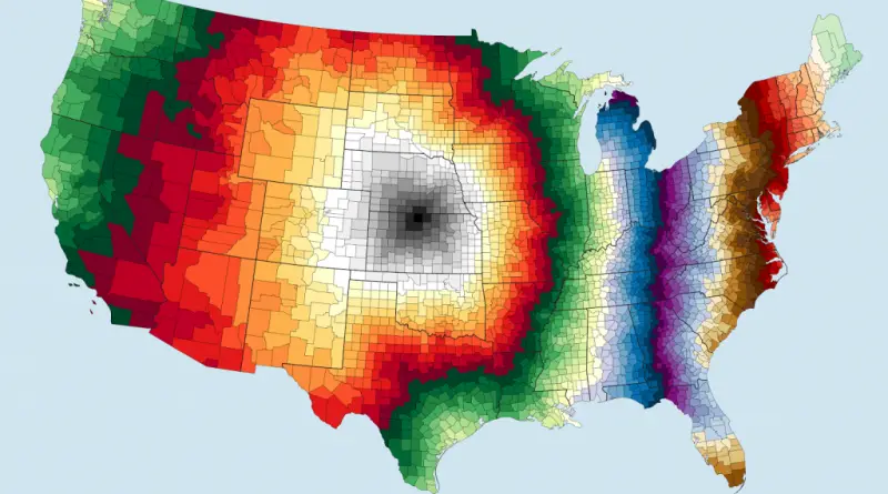
Range between record high and low temperatures in the Unites States in degrees Fahrenheit

Reddit user: AquaMoonCoffee

Read more: Range between record high and low temperatures in the Unites States in degrees Fahrenheit →
Mapping Health
July 4, 2017 Alex

U.S. population access to hospitals in 20 miles with & without critical access hospitals

Read more: U.S. population access to hospitals in 20 miles with & without critical access hospitals →
World
July 4, 2017 Alex

U.S. Counties Away From the Geographic Center of the Lower 48

Counties away From the geographic center of the lower 48 Reddit user: sendherhome22 Number of counties from the Atlantic or

Read more: U.S. Counties Away From the Geographic Center of the Lower 48 →
Economic mapsEthnic mapsMapping Stereotypes
July 3, 2017 Alex

Antisemitism in Europe

Percentage of population that hold antisemitic views.

Read more: Antisemitism in Europe →
Old maps
July 3, 2017 Alex

A British Map of New York City (1776)

Related posts: – New Netherland settlements & areas of influence (1614 – 1674) – Urban Scratchoff – Interactive map of

Read more: A British Map of New York City (1776) →
DemographyForecasts
July 3, 2017 Alex

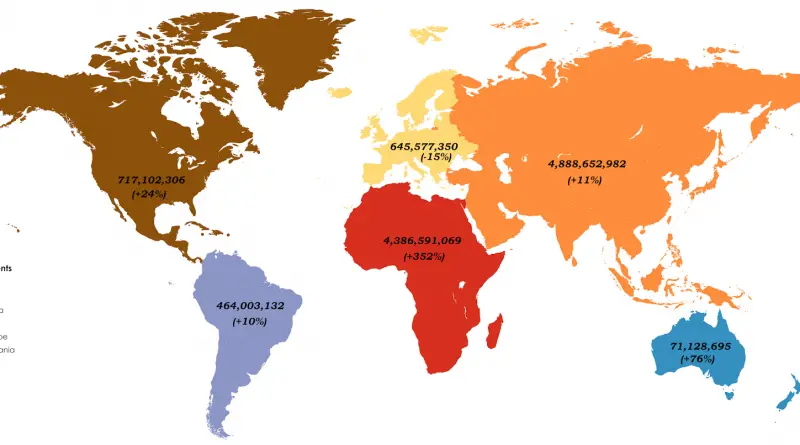
The Population of Continents by 2100

Read more: The Population of Continents by 2100 →
Economic mapsForecasts
July 3, 2017 Alex

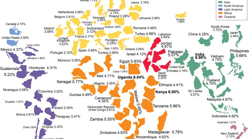
World map of economic growth

Predicted economic growth rate (%) annually to 2024.

Read more: World map of economic growth →
World
July 3, 2017 Alex

North Circumpolar Region (2017)

Base map features from Northern Circumpolar Cartographic Base Data at 1: 9 000 000 and Canadian Geographical Names Data Base,

Read more: North Circumpolar Region (2017) →
EducationFood
July 2, 2017 Alex

Japan & Korea at night

Night lights of Korea Source: AJgloe

Read more: Japan & Korea at night →
CartogramsEconomic mapsForecasts
July 2, 2017 Alex

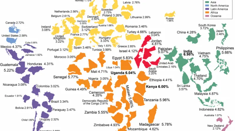
World map of economic growth

Predicted economic growth rate (%) annually to 2024. Source: www.howmach.net

Read more: World map of economic growth →
Does your U.S. county have a McDonald’s
BusinessFood
July 2, 2017 Alex

McDonald’s Stores Across the United States

Ever wondered how McDonald’s restaurants are spread across America? Our analysis reveals surprising patterns in the fast-food giant’s presence – and absence – throughout the United States, with some unexpected findings about where you can’t get a Big Mac.

Read more: McDonald’s Stores Across the United States →
Page 139 of 521« First«...135136137138139140141142143...»Last »

Trending now

  • Soviet detailed map
    Detailed Cold War-era Soviet military map of the San Francisco Bay area (1980)Oct 22, 2017
  • Human races of the 19th century
    How Has Our View of Human Diversity Changed Since the 19th Century?Oct 22, 2017
  • World map of Y-DNA Haplogroups
    World map of Y-DNA HaplogroupsMay 17, 2017

Related Products

  • Push pin maps
  • Globe drinks cabinets
  • Maps of the United States
  • Board games
  • Monopoly
  • Map-based strategy board games
  • History Board Games
  • Coloring Books
  • Handheld GPS
  • GPS Watches
  • GPS Trackers

Vivid Maps Tools

  • Convert Latitude/Longitude
  • Elevation Finder
  • Distance Calculator
  • Kilometers to Miles Distance & Length Converter
  • Weight Converter
  • Volume Converter
  • Daylight Comparison
  • Time Zone Converter
  • Antipodes Map
  • Find cities with a similar climate
  • Find cities with a similar climate (2050)
  • How hot cities could be in 2050
  • The U.S. Population Lines

Stay connected

Get the latest maps, insights and updates delivered to your inbox.

Unsubscribe anytime.

VividMaps

Maps that explain the world.

Beautiful, data-rich maps to help you understand our world — its people, places and connections.

Explore

World map World atlas Map posters Globes

Company

About Privacy Contact

Stay connected

Follow us for the latest maps, insights and updates.

Independent WebsiteVirusScanner trust report for vividmaps.com
© 2026 Vivid Maps. All rights reserved.
A more connected world