The percentage of Muslims in the U.S. (1980 – 2010)
Muslims as a percentage of all residents, 1980 – 2010 YouTube version of the map Muslims as a percentage of
Read More
Muslims as a percentage of all residents, 1980 – 2010 YouTube version of the map Muslims as a percentage of
Read MoreNorth America 167 years ago today: Compromise of 1850 (09 Sep 1850). With its population booming, California wanted to join
Read MoreReddit user: eivarXlithuania
Read MoreBlue: Buses Green: Light Rail Red: Subways Yellow: Trains Orange: Cabie cars Pink: Ferries Data from Transitland, an open-source data
Read More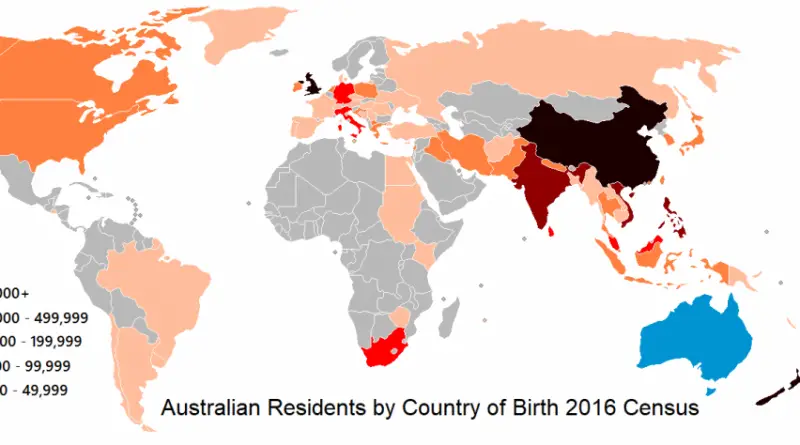
All up 6.1 million out of a population of 24.6 million Australians were born overseas representing 26% of the population.
Read MoreReddit user: lursh123
Read More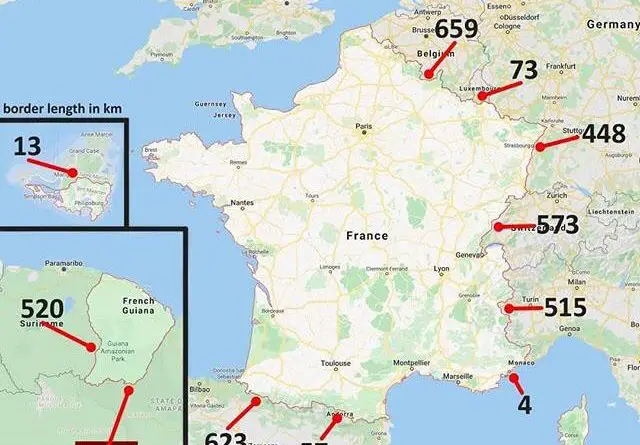
France shares borders with 11 countries across the globe, including some unexpected ones. Learn about the unique stories behind these boundaries, from Caribbean islands to South America.
Read MoreEthnographic Map of Europe (1900) National Geographic map of the ethnic groups of Europe (1919) Europe 1300 Vs 1900
Read More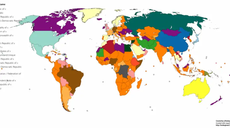
Reddit user: Hexbugman213
Read More
Map of the U.S. states and Canadian provinces with active separatist movements. Active Separatist Movements in North and Central America
Read More